


Survey Data
Reg No
32403706
Rating
Regional
Categories of Special Interest
Archaeological, Architectural, Social
Original Use
Graveyard/cemetery
In Use As
Graveyard/cemetery
Date
1880 - 1900
Coordinates
146495, 310104
Date Recorded
24/08/2004
Date Updated
--/--/--
Description
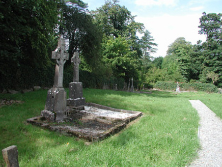
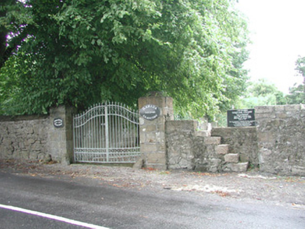
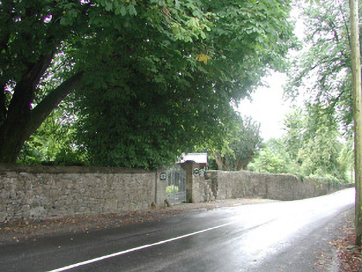
Cemetery laid out, c. 1890. Uncoursed rubble stone boundary wall, concrete coping added c. 1950. Coursed ashlar stone gate piers with cylindrical domed carriage wheel deflectors. Decorative wrought-iron double gates. Stone style to east of gates with stone steeps let into wall thickness. Grass lawns, gravelled paths, nineteenth and twentieth century graves marked by low stone plinths with several engraved and carved Celtic crosses. Rubble stone, ivy-covered boundary walls to east, north and west. Fronts to main road.
Appraisal
This cemetery occupies the site of a monastery founded in 1432 but contains no visible traces of it. The roadside wall and gateway, with graveyard behind, provide a pleasing boundary.