
Survey Data
Reg No
31312215
Rating
Regional
Categories of Special Interest
Architectural, Scientific, Technical
Original Use
Bridge
In Use As
Bridge
Date
1846 - 1857
Coordinates
128041, 252594
Date Recorded
14/12/2010
Date Updated
--/--/--
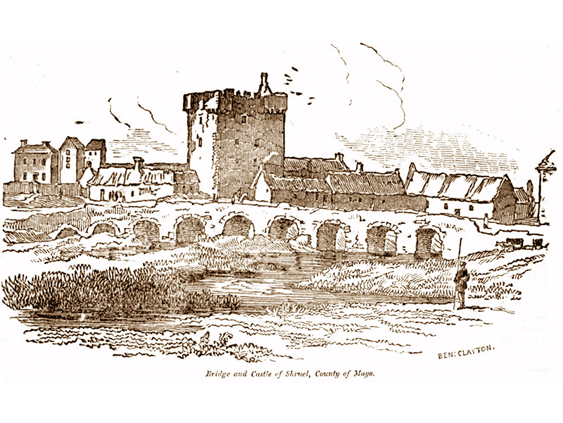
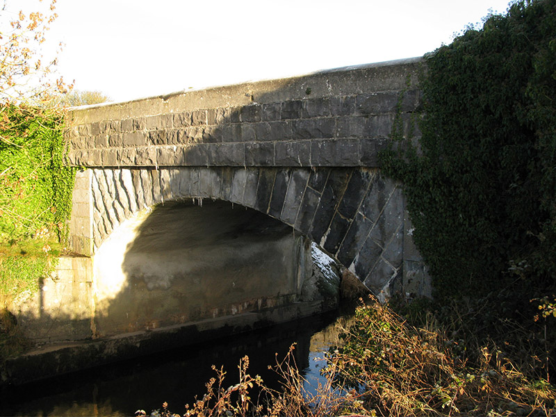
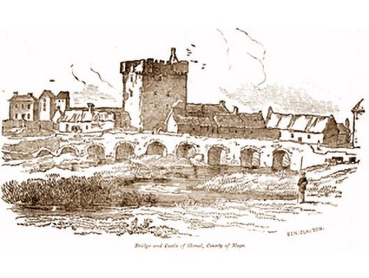
Description
Single-arch road bridge over river, extant 1857. Part creeper- or ivy-covered tuck pointed snecked rock faced limestone battered walls with benchmark-inscribed drag edged rock faced limestone ashlar parapets having mass-concrete rounded coping. Single segmental arch between drag edged tooled limestone ashlar "bas-relief" piers with drag edged rock faced limestone ashlar radiating voussoirs. Sited spanning Black River with unkempt banks to river.
Appraisal
A bridge representing an integral component of the mid nineteenth-century civil engineering heritage of south County Mayo with the architectural value of the composition, one succeeding an eighteenth-century bridge illustrated in "The Dublin Penny Journal" (9th February, 1833), confirmed not only by the rock faced surface finish demonstrating good quality workmanship, but also by the elegant "sweep" of the arch making a pleasing visual statement at a crossing over the Black River: meanwhile, a much weathered benchmark remains of additional interest for the connections with cartography and the preparation of maps by the Ordnance Survey (established 1824).