
Survey Data
Reg No
31311126
Rating
Regional
Categories of Special Interest
Architectural, Technical
Previous Name
Castlemagarret House
Original Use
Bridge
Date
1800 - 1838
Coordinates
135266, 271487
Date Recorded
18/02/2011
Date Updated
--/--/--
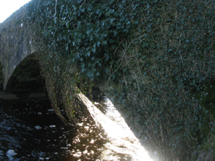
Description
Single-arch road bridge over river, extant 1838. Now disused. Creeper- or ivy-covered walls with overgrown coping to parapets. Single segmental arch with limestone ashlar voussoirs. Set in unkempt grounds shared with Castlemacgarrett spanning Robe River with overgrown banks to river.
Appraisal
A bridge contributing positively to the group and setting values of the Castlemacgarrett estate with the architectural value of the composition, one annotated as "Linden's Bridge" on the third edition of the Ordnance Survey (surveyed 1925; published 1930), confirmed not only by the sheer limestone dressings demonstrating good quality workmanship, but also by the elegant "sweep" of the arch making a pleasing visual statement at a crossing over the Robe Rive.