

Survey Data
Reg No
31311118
Rating
Regional
Categories of Special Interest
Architectural, Scientific, Technical
Original Use
Bridge
In Use As
Bridge
Date
1700 - 1838
Coordinates
133769, 271005
Date Recorded
10/12/2010
Date Updated
--/--/--
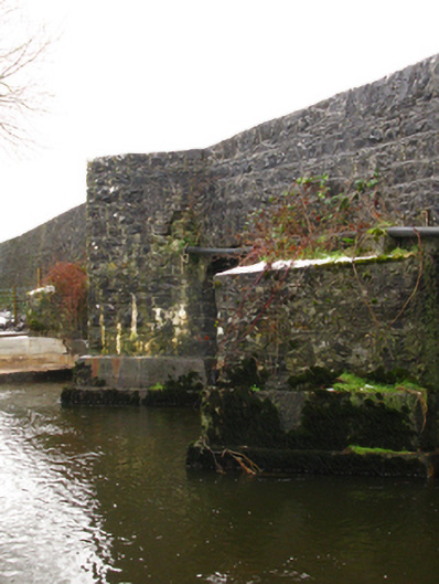
Description
Five-arch road bridge over river, extant 1838. "Repaired". Repointed coursed rubble limestone walls centred on triangular cutwaters to piers to upriver (north-east) elevation on mass concrete battered bases including central triangular cutwater-cum-pedestrian refuge with repointed squared limestone soldier course coping to parapets. Series of five arches with repointed voussoirs. Sited spanning Robe River with unkempt banks to river.
Appraisal
A narrow bridge representing an integral component of the civil engineering heritage of Crossboyne: meanwhile, a benchmark remains of additional interest for the connections with cartography and the preparation of maps by the Ordnance Survey (established 1824).