
Survey Data
Reg No
31311104
Rating
Regional
Categories of Special Interest
Architectural, Scientific, Technical
Original Use
Bridge
In Use As
Bridge
Date
1850 - 1855
Coordinates
128315, 272069
Date Recorded
10/12/2010
Date Updated
--/--/--
Description
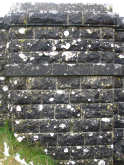
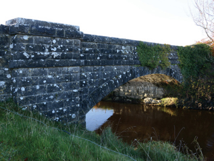
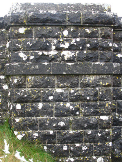
Single-arch road bridge over river, built 1852; extant 1894. Part creeper- or ivy-covered tuck pointed rock faced limestone ashlar walls between drag edged rock faced limestone ashlar piers with drag edged tooled cut-limestone stringcourses supporting parapets having drag edged rock faced cut-limestone coping. Single segmental arch with drag edged rock faced limestone ashlar voussoirs. Sited spanning Robe River with unkempt grass banks to river.
Appraisal
A bridge identified as an integral component of the mid nineteenth-century civil engineering heritage of south County Mayo on account of the connections with the county-wide programme of famine relief drainage works completed under the Drainage (Ireland) Act, 1846, with the architectural value of the composition, one erected 'in lieu of [an] old structure which formerly existed there' (Twenty-First Report… 1853, 131), confirmed not only by the robust rock faced surface finish demonstrating good quality workmanship, but also by the elegant "sweep" of the arch making a pleasing visual statement at a crossing over the Robe River: meanwhile, a discreet benchmark remains of additional interest for the connections with cartography and the preparation of maps by the Ordnance Survey (established 1824).