

Survey Data
Reg No
31311101
Rating
Regional
Categories of Special Interest
Architectural, Technical
Original Use
Bridge
In Use As
Bridge
Date
1850 - 1855
Coordinates
126919, 269659
Date Recorded
15/01/2013
Date Updated
--/--/--
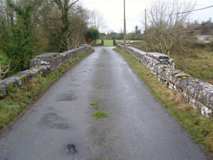
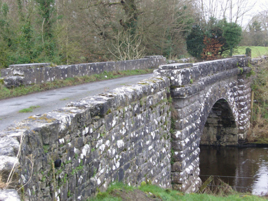
Description
Single-arch "occupation bridge" over river, built 1852; extant 1894. Tuck pointed rock faced limestone ashlar walls between drag edged rock faced limestone ashlar piers with drag edged rock faced cut-limestone stringcourses supporting drag edged rock faced cut-limestone dwarf parapets. Single segmental arch with drag edged rock faced limestone ashlar voussoirs. Set in grounds shared with Hollymount House spanning Robe River with unkempt grass banks to river.
Appraisal
An "occupation bridge" identified as an integral component of the mid nineteenth-century civil engineering heritage of south County Mayo on account of the connections with the county-wide programme of famine relief drainage works completed under the Drainage (Ireland) Act, 1846, with the architectural value of the composition, one recalling the nearby Hollybrook Bridge (1852; see 31311104), confirmed not only by the robust rock faced surface finish demonstrating good quality workmanship, but also by the elegant "sweep" of the arch making a pleasing visual statement at a crossing over the Robe River.