Survey Data
Reg No
31311028
Rating
Regional
Categories of Special Interest
Architectural, Scientific, Technical
Original Use
Bridge
In Use As
Bridge
Date
1835 - 1845
Coordinates
125981, 268615
Date Recorded
07/03/2011
Date Updated
--/--/--
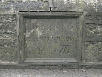
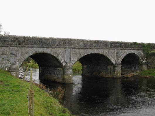
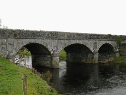
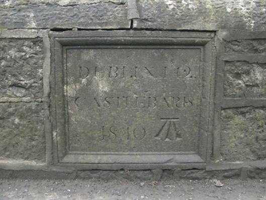
Description
Three-arch road bridge over river, dated 1840. "Underpinned", 1852. Tuck pointed coursed or snecked tooled limestone battered walls centred on tooled limestone ashlar rounded cutwaters to piers having domed capping with drag edged tooled cut-limestone stringcourses supporting parapets having lichen-covered cut-limestone rounded coping centred on benchmark-inscribed drag edged cut-limestone date stone-cum-mile stone ("1840"). Series of three segmental arches between tooled limestone ashlar panelled "pilasters" with repointed drag edged tooled limestone ashlar radiating voussoirs centred on drag edged tooled cut-limestone keystones. Sited spanning Robe River with unkempt grass banks to river.
Appraisal
A Classically-detailed bridge regarded as an important component of the mid nineteenth-century civil engineering heritage of Hollymount with the architectural value of the composition confirmed not only by the "sparrow pecked" sheer limestone dressings demonstrating good quality workmanship, but also by the elegant "sweep" of the arches making a pleasing visual statement at a crossing over the Robe River: meanwhile, a benchmark remains of additional interest for the connections with cartography and the preparation of maps by the Ordnance Survey (established 1824).