Survey Data
Reg No
31310702
Rating
Regional
Categories of Special Interest
Architectural, Scientific, Technical
Original Use
Bridge
In Use As
Bridge
Date
1800 - 1838
Coordinates
91789, 269478
Date Recorded
07/03/2011
Date Updated
--/--/--
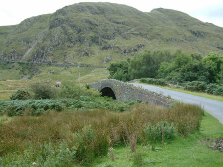
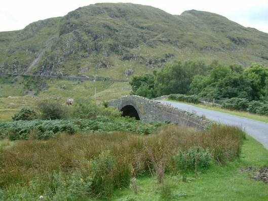
Description
Single-arch hump back road bridge over river, extant 1838. Part creeper- or ivy-covered walls with soldier course-detailed lichen-covered rough hewn limestone coping to parapets. Single segmental arch with tooled limestone ashlar voussoirs. Sited spanning Glenlaur River with gorse-covered unkempt banks to river.
Appraisal
A bridge representing an integral component of the early nineteenth-century civil engineering heritage of south County Mayo with the architectural value of the composition confirmed not only by the construction in unrefined local fieldstone offset by "sparrow pecked" sheer limestone dressings demonstrating good quality workmanship, but also by the elegant "sweep" of the arch making a pleasing visual statement at a crossing over the Glenlaur River in the shadow of the Sheeffry Hills: meanwhile, a much-weathered benchmark remains of additional interest for the connections with cartography and the preparation of maps by the Ordnance Survey (established 1824).