


Survey Data
Reg No
31310011
Rating
Regional
Categories of Special Interest
Architectural, Artistic, Scientific
Original Use
Gates/railings/walls
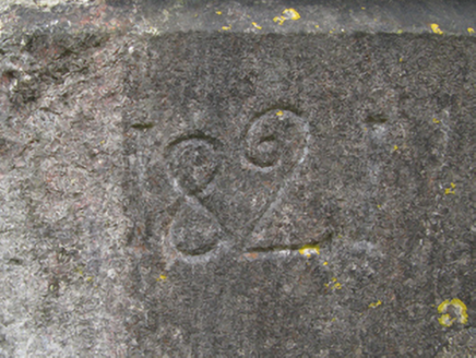
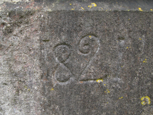
Date
1820 - 1825
Coordinates
119617, 274550
Date Recorded
01/12/2011
Date Updated
--/--/--
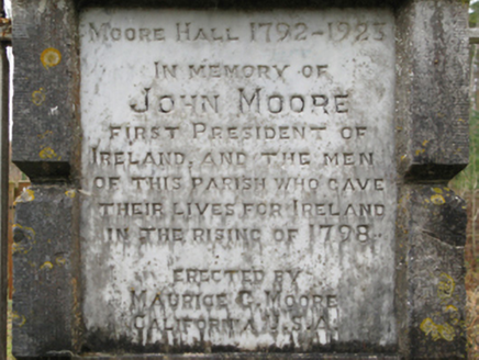
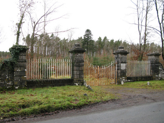
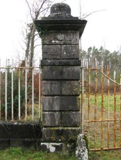
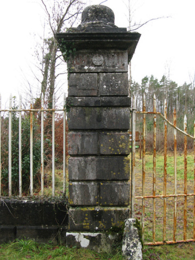
Description
Gateway, dated 1821, on a symmetrical plan comprising pair of benchmark-inscribed drag edged rusticated limestone ashlar piers on monolithic plinths having ogee-detailed cornices on "Patera"-detailed panelled friezes below capping supporting wrought iron double gates with drag edged rusticated limestone ashlar outer piers on monolithic plinths having ogee-detailed cornices on "Patera"-detailed panelled friezes below capping supporting wrought iron railings. Now disused. Road fronted at entrance to grounds of Moore Hall.
Appraisal
A gateway not only making a pleasing visual statement in a sylvan street scene at the principal entrance on to the grounds of the Moore Hall estate, but also clearly illustrating the continued development or "improvement" of the estate with a relic reclaimed from the nearby Newbrook House estate (Moore 1912 II, 254; Moore 1914 III, 307): meanwhile, a benchmark remains of additional interest for the connections with cartography and the preparation of maps by the Ordnance Survey (established 1824).