

Survey Data
Reg No
31308018
Rating
Regional
Categories of Special Interest
Architectural, Scientific, Technical
Original Use
Bridge
In Use As
Bridge
Date
1870 - 1875
Coordinates
135406, 291431
Date Recorded
29/11/2010
Date Updated
--/--/--
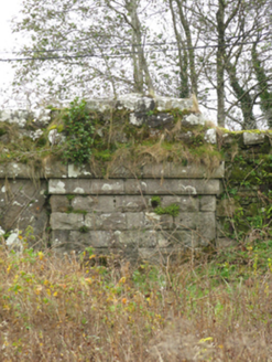
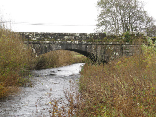
Description
Single-arch road bridge over river, built 1871[?]; extant 1895. Drag edged rock faced limestone ashlar walls between drag edged rock faced limestone ashlar piers with drag edged tooled cut-limestone stringcourses supporting parapets having lichen-covered rock faced cut-limestone coping. Single segmental arch with drag edged tooled limestone ashlar radiating voussoirs. Sited spanning Glore River with unkempt banks to river.
Appraisal
A bridge representing an integral component of the nineteenth-century civil engineering of County Mayo with the architectural value of the composition, one erected as part of the drainage works completed in the so-called "Island Lakes and Glore River Drainage District" under the Drainage and Improvement of Lands Act (Ireland), 1863 (Public Bills 1868-9 II, 4-6), confirmed not only by the rock faced surface finish offset by "sparrow pecked" sheer limestone dressings demonstrating good quality workmanship, but also by the elegant "sweep" of the arch making a pleasing visual statement at a crossing over the Glore River: meanwhile, a discreet benchmark remains of additional interest for the connections with cartography and the preparation of maps by the Ordnance Survey (established 1824).