Survey Data
Reg No
31302110
Rating
Regional
Categories of Special Interest
Architectural, Scientific, Technical
Original Use
Bridge
In Use As
Bridge
Date
1800 - 1838
Coordinates
114354, 326050
Date Recorded
07/03/2011
Date Updated
--/--/--
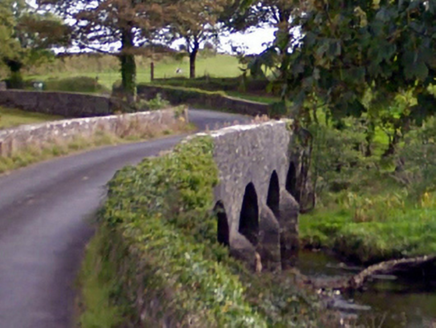
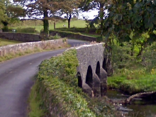
Description
Six-arch road bridge over river, extant 1838[?]. Part creeper- or ivy-covered walls centred on triangular cutwaters to piers having pyramidal capping with lichen-covered coping to parapets. Series of six round arches with limestone ashlar voussoirs. Sited spanning Owenmore River or Cloonaghmore River with unkempt grass banks to river.
Appraisal
A bridge representing an integral component of the civil engineering heritage of County Mayo with the architectural value of the composition confirmed not only by the sheer limestone dressings demonstrating good quality workmanship, but also by the elegant "sweep" of the arches making a pleasing visual statement at a crossing over the Owenmore River or Cloonaghmore River: meanwhile, a benchmark remains of additional interest for the connections with cartography and the preparation of maps by the Ordnance Survey (established 1824).