
Survey Data
Reg No
31302109
Rating
Regional
Categories of Special Interest
Architectural, Scientific, Technical
Original Use
Bridge
In Use As
Bridge
Date
1700 - 1838
Coordinates
115708, 328676
Date Recorded
11/02/2011
Date Updated
--/--/--
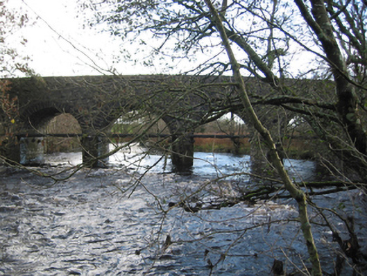
Description
Eight-arch hump back road bridge over river, extant 1838. Part creeper- or ivy-covered walls centred on triangular cutwaters to piers having rendered pyramidal capping with sections of replacement mass concrete coping to parapets. Series of eight segmental arches with cut-limestone voussoirs. Sited spanning Cloonaghmore River or Palmerstown River with unkempt grass banks to river.
Appraisal
A lengthy bridge representing an integral component of the civil engineering heritage of County Mayo with the architectural value of the composition suggested not only by the traditional construction in unrefined local fieldstone offset by limestone dressings demonstrating good quality workmanship, but also by the elegant "sweep" of the arches making a pleasing visual statement at a crossing over the Cloonaghmore River or Palmerstown River: meanwhile, a discreet benchmark remains of additional interest for the connections with cartography and the preparation of maps by the Ordnance Survey (established 1824).