Survey Data
Reg No
31300705
Rating
Regional
Categories of Special Interest
Architectural, Scientific, Technical
Original Use
Bridge
In Use As
Bridge
Date
1840 - 1849
Coordinates
110134, 338295
Date Recorded
31/01/2011
Date Updated
--/--/--
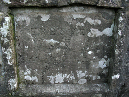
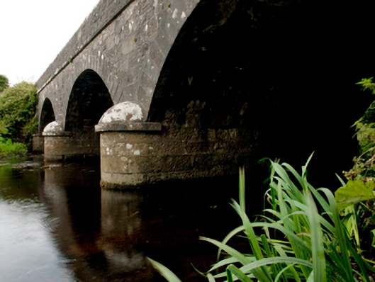
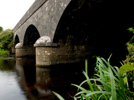
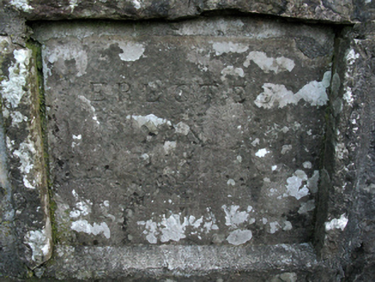
Description
Three-arch road bridge over river, dated 184-; extant 1896. Tuck pointed snecked limestone walls centred on tooled limestone ashlar rounded triangular cutwaters to piers having domed pyramidal capping with cut-limestone stringcourses supporting parapets having lichen-covered hammered limestone rounded coping centred on benchmark-inscribed date stone ("184-"). Series of three segmental arches with drag edged tooled limestone ashlar voussoirs. Sited spanning Ballinglen River with unkempt banks to river.
Appraisal
A bridge representing an integral component of the mid nineteenth-century civil engineering heritage of the outskirts of Ballycastle with the architectural value of the composition, one evoking favourable comparisons with the contemporary Killerduff Bridge (184-) nearby (see 31300704), confirmed not only by the "sparrow pecked" sheer limestone dressings demonstrating good quality workmanship, but also by the elegant "sweep" of the arches making a pleasing visual statement at a crossing over the Ballinglen River: meanwhile, a much-weathered benchmark remains of additional interest for the connections with cartography and the preparation of maps by the Ordnance Survey (established 1824).