Survey Data
Reg No
30410505
Rating
Regional
Categories of Special Interest
Architectural, Technical
Original Use
Bridge
In Use As
Bridge
Date
1770 - 1790
Coordinates
157091, 214949
Date Recorded
17/09/2009
Date Updated
--/--/--
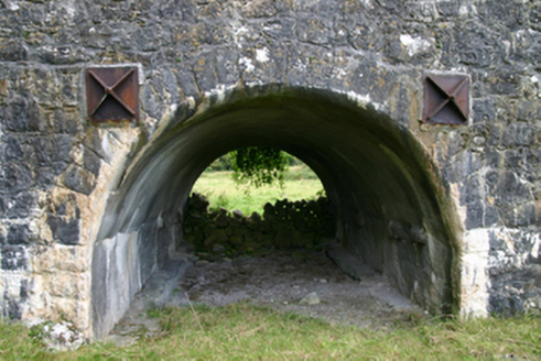
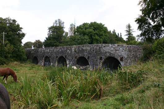
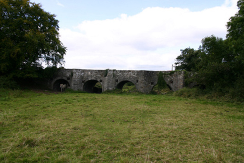
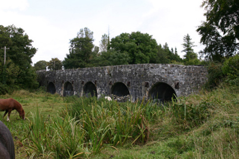
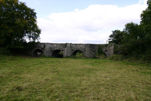
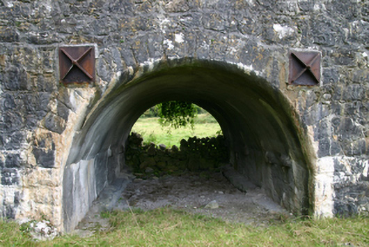
Description
Seven-arch limestone bridge, built c.1780, carrying road over River Duniry, comprising two river arches and five flood arches. Rubble walls and parapet walls with vertical coping stones. Round arches with dressed voussoirs, with paired cast-iron square tie-plates to spandrels. V-cutwaters to upriver (east) elevation, rising to form pedestrian refuges, having curved walls to inner face of parapet. Soffits have been gunnelled. Curved rubble approach walls. Square-headed drain openings to parapets.
Appraisal
This impressive bridge stands as a testament to the skill of local engineers and stone masons of the eighteenth century. The numerous flood arches and interesting combination pedestrian refuges and cutwaters illustrate the ways in which such structures are tailored to local traffic and river conditions.