
Survey Data
Reg No
22901815
Rating
Regional
Categories of Special Interest
Architectural, Scientific, Technical
Original Use
Bridge
In Use As
Bridge
Date
1860 - 1865
Coordinates
266019, 109671
Date Recorded
21/08/2003
Date Updated
--/--/--
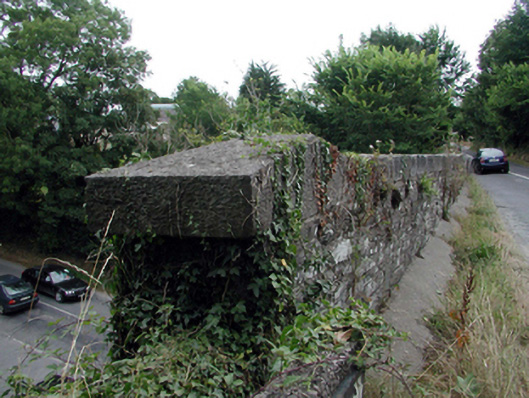
Description
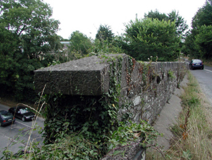
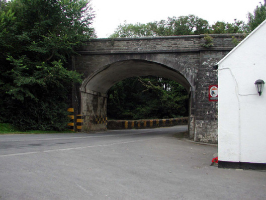
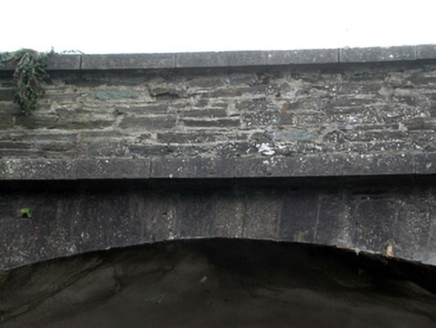
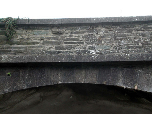
Single-arch bridge over road, built 1862-3. Coursed rubble limestone walls between coursed rubble limestone battered piers with margined tooled cut-limestone chamfered stringcourses supporting parapets having margined tooled cut-limestone coping. Single elliptical arch with margined tooled limestone ashlar crow stepped voussoirs centred on margined tooled cut-limestone keystones. Sited spanning road.
Appraisal
A bridge representing an integral component of the mid nineteenth-century civil engineering heritage of County Waterford with the architectural value of the composition, one allegedly erected in connection with an ill-fated attempt to open a railway line between County Waterford and County Wexford via Passage East and Ballyhack, confirmed not only by the sheer blue-grey limestone dressings demonstrating good quality workmanship, but also by the elegant "sweep" of the arch making a pleasing visual statement in a sylvan street scene: meanwhile, a discreet benchmark remains of additional interest for the connections with cartography and the preparation of maps by the Ordnance Survey (established 1824). NOTE: A pair of borough boundary plates supplied (1980) by Waterford Ironfounders (established 1901) carry the names of Alderman Stephen Rogers (----), Michael Doody (----) and P.H. Flood (----), City Engineer, and recall an earlier borough boundary plate (1896) at Gibbethill (see 22828035).