
Survey Data
Reg No
22826011
Rating
Regional
Categories of Special Interest
Architectural, Technical
Original Use
Bridge
In Use As
Bridge
Date
1800 - 1840
Coordinates
212755, 84200
Date Recorded
11/09/2003
Date Updated
--/--/--
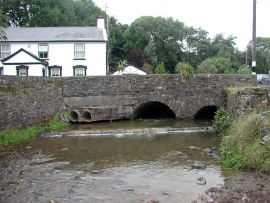
Description
Two-arch rubble stone road bridge over mill race, c.1820. Random rubble stone wall to south elevation with lime mortar, and cut-stone coping to parapet. Unpainted roughcast wall to north elevation with cut-stone coping to parapet. Pair of segmental arches with rubble stone voussoirs, and squared rubble stone soffits having render over. Sited spanning Greagagh River with random rubble stone abutment walls having lime mortar, section of mass-concrete, c.1945, to south-west, and cut-stone coping.
Appraisal
An appealing bridge of modest appearance, which enhances the quality of the townscape. The construction in unrefined rubble stone serves to integrate the structure into the surrounding landscape. The bridge forms an important element of the civil engineering heritage of County Waterford, as identified by the formation of the arches that have retained their original profile.