
Survey Data
Reg No
22204701
Rating
Regional
Categories of Special Interest
Archaeological, Architectural, Historical, Technical
Original Use
Bridge
In Use As
Bridge
Date
1400 - 1820
Coordinates
209038, 154088
Date Recorded
29/06/2005
Date Updated
--/--/--
Description
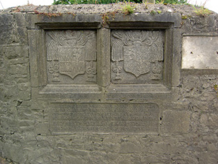
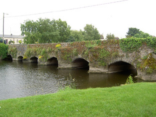
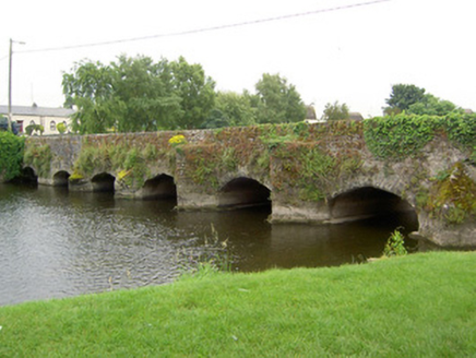
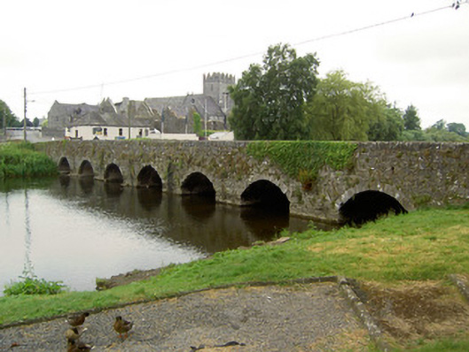
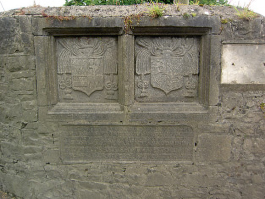
Eight-arch road bridge over River Suir, built c. 1410, with alterations to south elevation 1626, the westernmost arch altered and a bank built to channel a millrace c. 1800. Random rubble limestone with render remaining to some sections of north elevation. Pointed segmental arches with roughly-dressed voussoirs to west end of north elevation, lower segmental arches with dressed voussoirs to east, and having round arches to south with cut limestone voussoirs. Rendered V-shaped cutwaters to west half of north elevation, some to arch level with sloping triangular caps, and others to just below parapet level and perhaps originally containing pedestrian refuges. Plaque dated 1626 with coats-of-arms of James Butler Lord Dunboyne and Lady Margaret O'Brien in moulded panel with inscription beneath set into west end of north parapet of bridge. Weir to north of bridge.
Appraisal
This bridge spans many periods and is interesting as a record of bridge construction from the fifteenth to the nineteenth centuries. The earlier north elevation is identical in span, rise and overall shape to Adare Bridge, Co. Limerick, which dates to 1410, additionally V-cutwaters on this elevation rise to road level and may originally have served as pedestrian refuges, also indicating an early date. A bank was built in the late eighteenth or early nineteenth century, separating the westernmost arch and channelling a millrace from the weir via a corn mill still extant to the north. The plaque located on the west side of the bridge associates the Baron of Dunboyne, James Butler, and his wife Lady Margaret O'Brien, with the rebuilding of the bridge in 1626, and states that the bridge was originally constructed by Nicholas Cowley.