


Survey Data
Reg No
20912517
Rating
National
Categories of Special Interest
Archaeological, Architectural, Historical, Scientific, Social, Technical
Original Use
Fortification
Date
1675 - 1680
Coordinates
165517, 49362
Date Recorded
24/05/2009
Date Updated
--/--/--
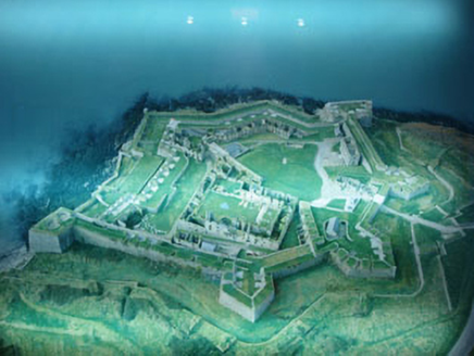
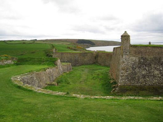
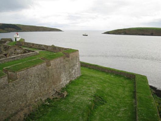
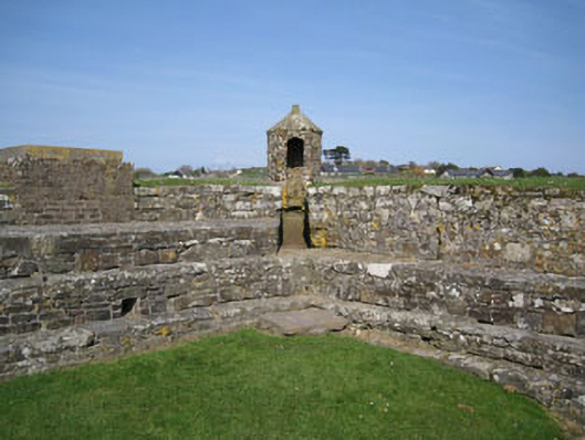
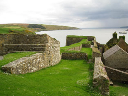
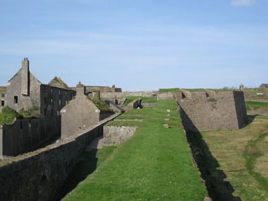
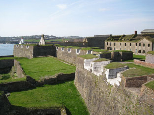
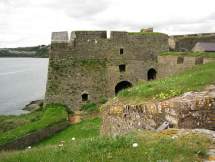
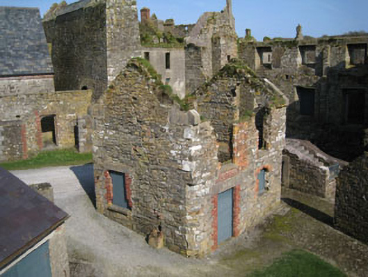
Description
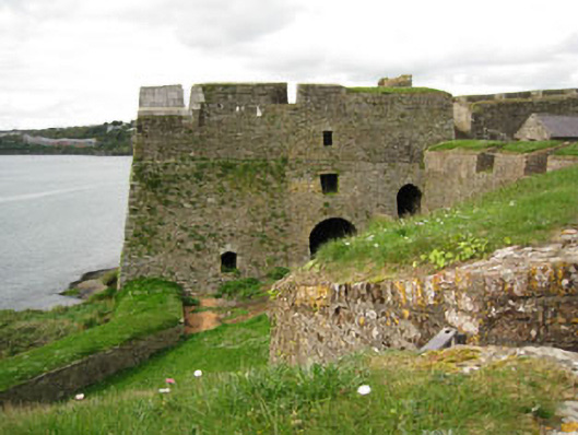
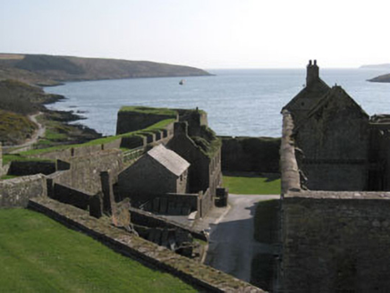
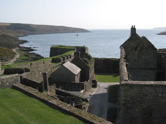
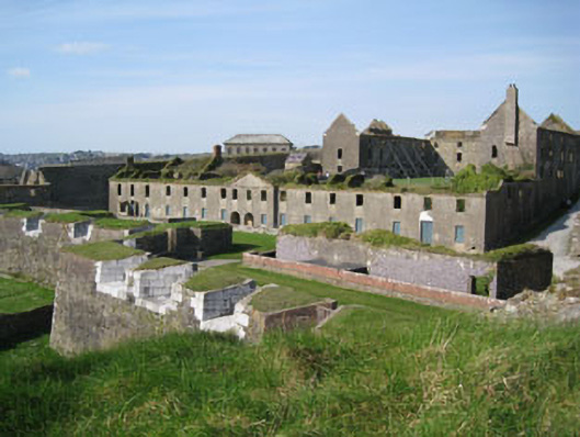
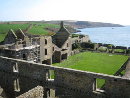
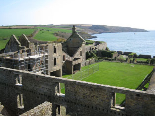
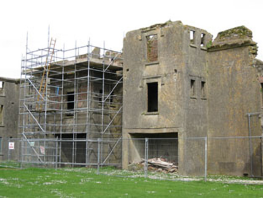
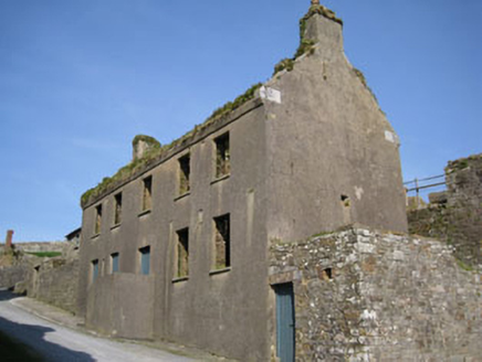
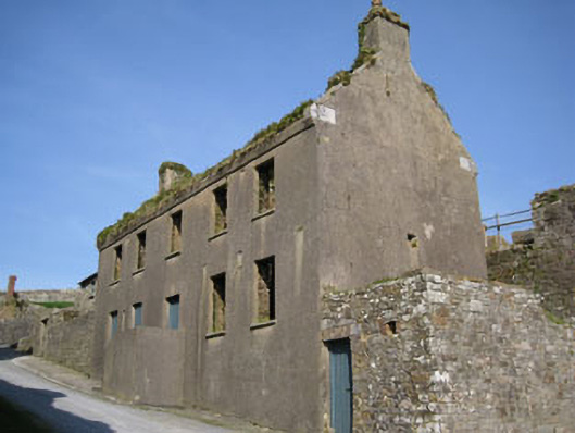
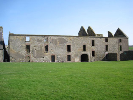
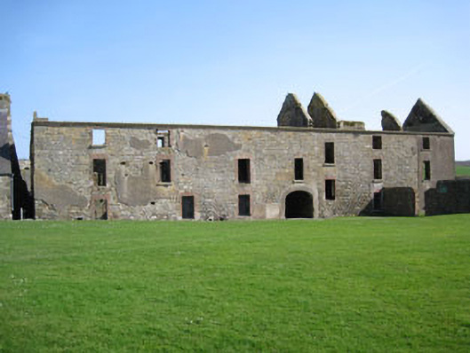
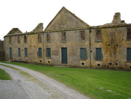
Star-shaped fort, commenced 1678, subsequently altered and modified, completed 1804. Comprising six-point outer Glacis to landward sides (north, east). Covered way and ditch to interior with dressed limestone retaining walls, traversing earthen and stone embankments to covered way perpendicular to ditch and glacis (intended to restrict movement around the covered way by enemy forces). Battered dressed rubble limestone outer blast walls spanning seaward (south, west) sides springing from bedrock, having ramparts and covered way to interior. Battered dressed limestone star shaped fort to interior of outer fortifications comprising five diamond shaped battered limestone bastions. Two to seaward side, named as Devil’s and Charles’ bastions, remainder facing inland, named as the North, Cockpit and Flagstaff bastions. Flagstaff bastion designed to act as Citadel, being defensible from both within and without the fort with Charles's bastion being added 1804. Interior ramparts to interconnecting curtain walls and bastions with parapet walls having rubble stone firing steps and splayed firing embrasures of mixed limestone block, rubble stone, yellow or red brick construction. Pair of circular swivel gun platforms to Charles’ bastion, further gun emplacements evident along seaward side walls with extensive length of curtain wall with multiple firing embrasures to south facing elevation of interior wall. Pepper pot sentry boxes to Cockpit bastion and outermost (south-west) point of seaward side outer blast wall. Recent concrete spire roofs with red brick eaves courses. Running bond red brick hexagonal plan walls with camber headed doorways facing to interior of fort. Pedimented limestone arched carriageway (north) formerly with draw bridge over ditch. Terracing to interior of fort having dressed rubble limestone retaining walls, having numerous buildings in various states of repair. Buildings include guard houses, ordnance sheds, officers' stables, barrack stores, engine house, a substantial magazine with accompanying blast wall, governor's house and soldiers' quarters.
Appraisal
This star shaped fort retains much of its seventeenth century fabric and form, as designed by engineer Captain Thomas Philips in 1685. Philips described the fort as badly sited being overlooked by high ground inland. The fort underwent minor changes to the ramparts and bastions, such as the blocking up or widening of some gun embrasures. It is possible that the fort was originally intended as an outwork with no bastion constructed at a south-west angle and the waterfront defences restricted to only two levels of batteries. The internal blast wall provided some protection to the east side of the fort from low trajectory fore from ships on the estuary to the west, and the west side of the interior from fire from high ground inland to the southeast. Most of this traverse survives, the part to the north having been demolished in the mid 18th century to allow for the construction of the western wing of the barracks built at the time. The earliest barracks consists of a continuous line of buildings following a zigzag line of the inner side of the upper rampart of the sea batteries giving maximum protection from cannon fire from enemy ships. These buildings may incorporate part of earlier buildings built on the site before 1685, lower cross walls of masonry, first floors of brickwork, indicating extensive rebuilding. The fort is a fine example of a seventeenth century fortification, however it was its vulnerability to its landward side that saw the fort finally fall into the hands of Williamite forces after a thirteen day siege in 1690.