


Survey Data
Reg No
20911141
Rating
Regional
Categories of Special Interest
Architectural, Technical
Original Use
Road (section of)
In Use As
Road (section of)
Date
1800 - 1840
Coordinates
161846, 50262
Date Recorded
08/04/2009
Date Updated
--/--/--
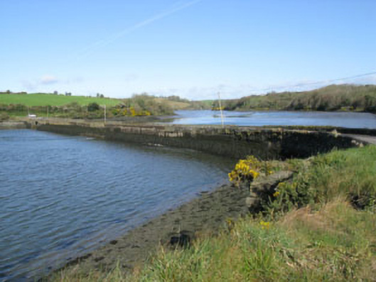
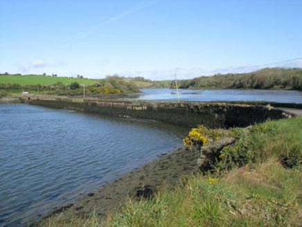
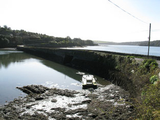
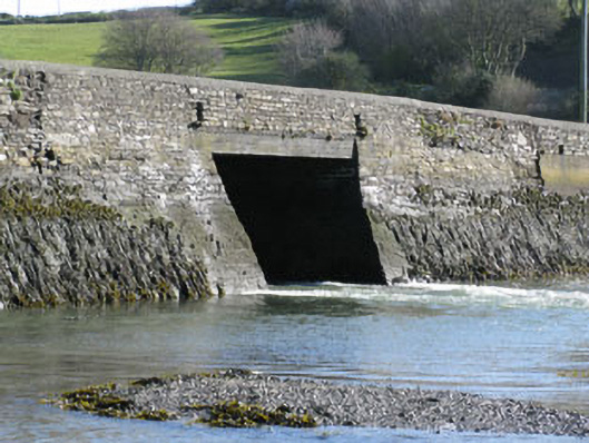
Description
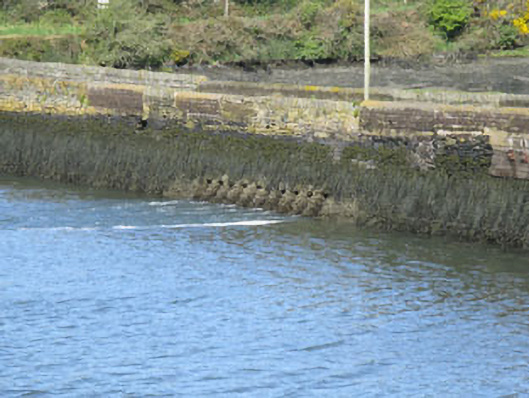
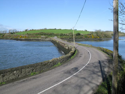
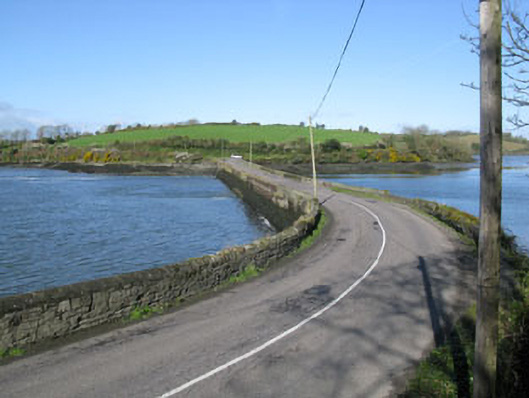
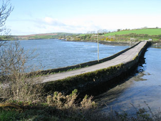
Freestanding rubble stone causeway, built c.1820, spanning White Castle creek. Battered rubble stone and stone block walls with recent concrete repairs and iron bracing to eastern end. Square-headed arch to western end having concrete lintels and rendered soffit springing from stone block piers. Group of ten square-headed arches to eastern end having rendered surrounds, soffits and battered piers. Rubble stone parapet walls with recent concrete block repairs having rubble stone and recent rendered coping.
Appraisal
This substantial causeway is an integral part of the local transport and communication networks and is ideally situated at the last possible bridging point over the White Castle Creek estuary. Its well-constructed stone block walls have carried far more and heavier traffic than its original builders could have imagined. Curiously the causeway features two different types of bridges, firstly a large square-headed arch contrasting against a group of ten smaller square-headed arches.