


Survey Data
Reg No
20907115
Rating
National
Categories of Special Interest
Archaeological, Architectural, Historical, Social
Original Use
Castle/fortified house
In Use As
Castle/fortified house
Date
1400 - 1500
Coordinates
141390, 72374
Date Recorded
13/03/2009
Date Updated
--/--/--
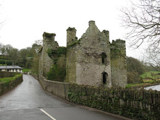
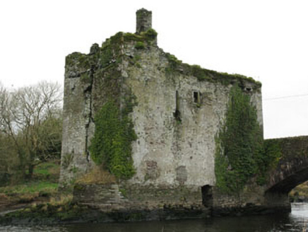
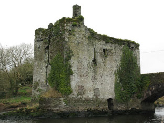
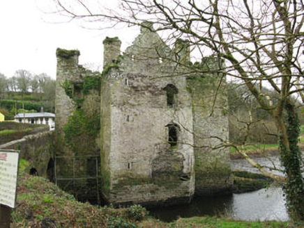
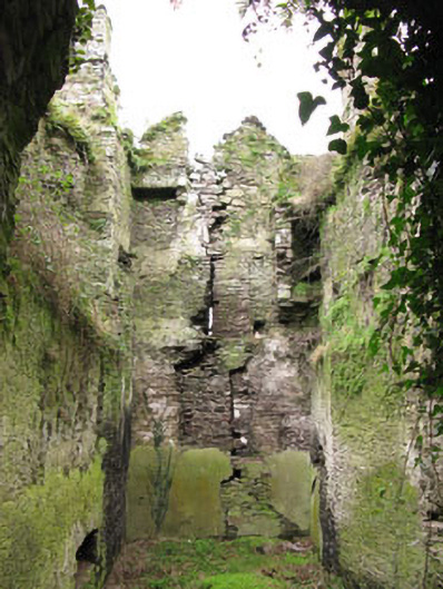
Description
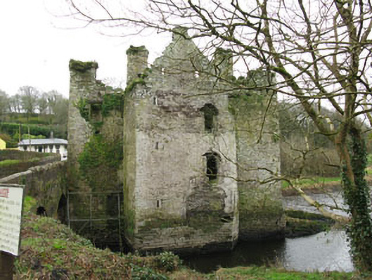
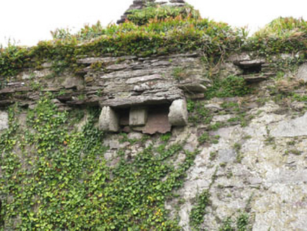
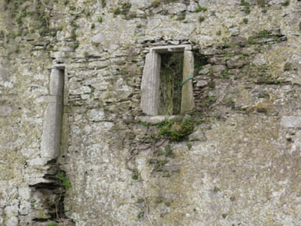
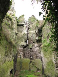
Detached T-plan multiple-bay three-storey over basement tower house, commenced c.1450 with numerous repairs and additions. Now ruinous. Roof now missing with rubble stone chimneystacks to gables, having projecting machicolation on cut limestone corbels to south elevation. Rubble stone walls with roughly dressed limestone quoins having subtle batter to base. Inscribed limestone plaque to east elevation. Mixed square-headed, pointed arch and lancet window openings with cut limestone sills and surrounds. Cut limestone label moulding to window on second floor of north elevation. Pointed arch door opening to east elevation with roughly dressed stone voussoirs. Door absent having recent mesh wiring in place. Remains of segmental-arch opening with cut limestone surround to north elevation, now blocked. Located on rocky outcrop in the River Lee with later rubble stone bridge attached to east.
Appraisal
The castle was built by the McCarthys of Muskerry, Kings of Munster, as a means to control the movement and transportation of goods and people along the river Lee. The castle has experienced a colourful history and was attacked on many occasion, including by Cromwell's forces. It is recorded that the garrison at Carrigdrohid was encouraged by Bishop Eagan who had been captured by Cromwell to hold the castle to the end, a price he paid for with his life. In 1656 following this attack the lands at Muskeery were surveyed prior to their distribution. At this point the castle was recorded as being in good repair and worth £100. However the adjoining bridge is recorded as being of timber and only passable by foot. Later in more peaceful times the Bowen family came to live here, ancestors of the writer Elizabeth Bowen. It was occupied into the mid eighteenth century, and the west part of the tower was used as a handball alley in the twentieth century. It now stands in water, due the flooding of the Lee Valley for the Hydroelectric Scheme.