Survey Data
Reg No
20512270
Rating
Regional
Categories of Special Interest
Historical, Social
Original Use
Street name plaque
In Use As
Street name plaque
Date
1775 - 1785
Coordinates
167486, 72244
Date Recorded
07/07/1997
Date Updated
--/--/--
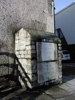
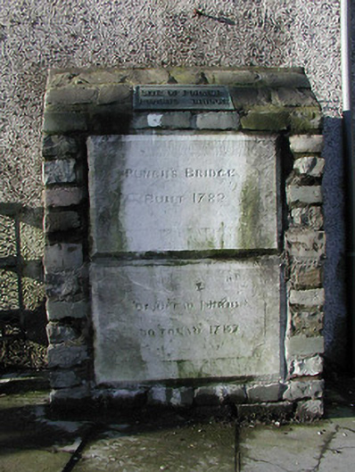
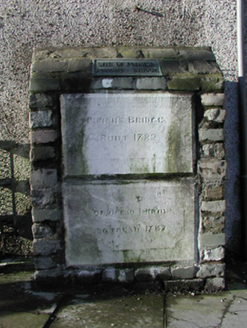
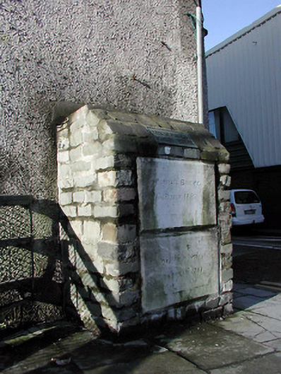
Description
Pair of limestone plaques, dated 1782, inscribed with English to the upper plaque and with Irish to the lower plaque. Set in rubble stone pier, having cast-iron plaque above, marking the site of former Punche's Bridge.
Appraisal
This pair of limestone plaques marks the former location of Punche's bridge. Set on the west side of Carroll's Quay, this pair is a physical reminder that this street was once a waterway. Carroll's Quay was built along a water channel, which was later covered over and the road was constructed. These limestone plaques contribute to the streetscape and are interesting reminders of the changes in the urban landscape. The plaques form part of an interesting group with the commemorative plaques for Carroll's Bridge, located to the south.