

Survey Data
Reg No
15702206
Rating
Regional
Categories of Special Interest
Architectural, Scientific, Technical
Original Use
Bridge
In Use As
Bridge
Date
1700 - 1840
Coordinates
321639, 146199
Date Recorded
17/08/2007
Date Updated
--/--/--
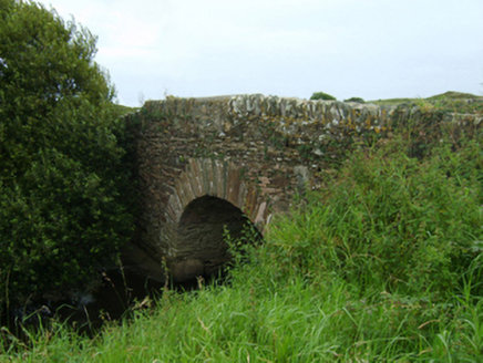
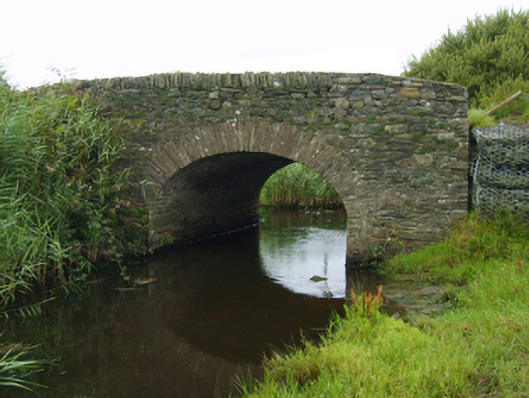
Description
Single-arch hump back road bridge over channel, extant 1840. Coursed rubble stone walls with lichen-spotted rubble stone soldier course coping to parapets. Single segmental arch with lichen-spotted voussoirs. Sited spanning channel with unkempt banks to channel.
Appraisal
A bridge representing an integral component of the civil engineering heritage of County Wexford: meanwhile, a largely weathered benchmark remains of additional interest for the connections with cartography and the preparation of maps by the Ordnance Survey (established 1824).