

Survey Data
Reg No
15701405
Rating
Regional
Categories of Special Interest
Architectural, Scientific, Technical
Original Use
Bridge
In Use As
Bridge
Date
1842 - 1904
Coordinates
286448, 147744
Date Recorded
24/08/2007
Date Updated
--/--/--
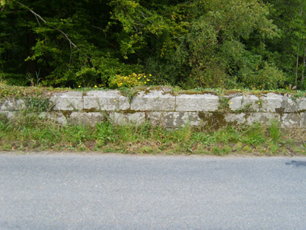
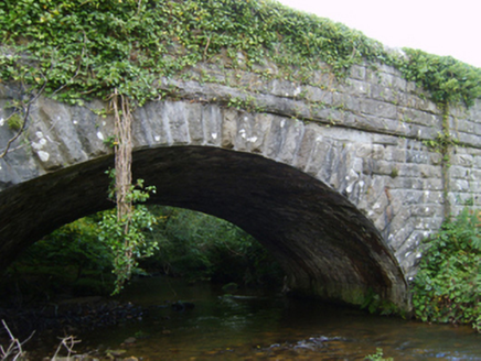
Description
Single-arch road bridge over river, extant 1904. Part creeper- or ivy-covered rock faced granite ashlar walls between margined rock faced granite ashlar piers with margined rock faced cut-granite stringcourses supporting parapets having lichen-spotted rock faced cut-granite coping. Single segmental arch with margined rock faced granite ashlar voussoirs centred on margined rock faced cut-granite keystones. Sited spanning Urrin River with unkempt banks to river.
Appraisal
A bridge representing an important component of the mid nineteenth-century civil engineering heritage of north County Wexford with the architectural value of the composition, one attributable to James Barry Farrell (1810-93), County Surveyor for County Wexford (appointed 1840; retired 1891; cf. 15609014), confirmed not only by the robust rock faced surface finish demonstrating good quality workmanship, but also by the elegant "sweep" of the arch making a pleasing visual statement at a crossing over the Urrin River: meanwhile, a benchmark remains of additional interest for the connections with cartography and the preparation of maps by the Ordnance Survey (established 1824).