
Survey Data
Reg No
15604003
Rating
Regional
Categories of Special Interest
Architectural, Scientific
Original Use
House
In Use As
House
Date
1900 - 1905
Coordinates
297134, 139516
Date Recorded
13/06/2005
Date Updated
--/--/--
Description
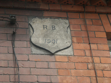
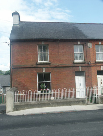
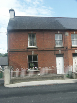
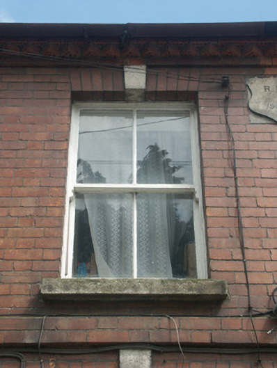
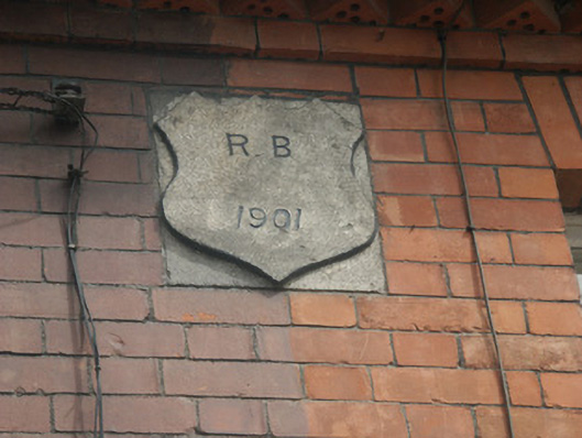
End-of-terrace two-bay two-storey red brick house, dated 1901, on a corner site. One of a pair. Pitched (shared) slate roof with terracotta ridge tiles, replacement rendered chimney stack having stepped capping, and cast-iron rainwater goods on red brick eaves having saw tooth-profiled course. Red brick Flemish bond wall to front (west) elevation on rendered plinth with red brick stringcourse to first floor, shared cut-granite shield date stone/plaque, and rendered walls to remainder. Square-headed window openings with cut-granite sills, red brick voussoirs having cut-granite keystones, and two-over-two timber sash windows. Square-headed door opening with cut-granite padstones, red brick voussoirs having cut-granite keystone, and timber panelled door having overlight. Interior with timber panelled shutters to window openings. Set back from line of street on a corner site with rendered plinth boundary wall having chamfered coping supporting iron railings, and iron gate [DS].
Appraisal
A pleasantly composed small-scale house built by a now unknown patron ("R.B.") as one of an identical pair (with 15604004) identified in the streetscape on account of the lively construction in vibrant mass-produced red brick with subtle dressed granite accents: in appearance, the house recalls the nearby contemporary (1898) Somerset House (15604020) connected with the same patron. Having been very well maintained, the house presents an early aspect with the elementary attributes surviving in place together with most of the original fabric, both to the exterior and to the interior, thus upholding the positive contribution made to the character of the local setting: meanwhile, a benchmark remains of additional importance for the connections with cartography and the preparation of maps by the Ordnance Survey.