
Survey Data
Reg No
15603153
Rating
Regional
Categories of Special Interest
Architectural
Original Use
Gates/railings/walls
In Use As
Gates/railings/walls
Date
1815 - 1825
Coordinates
297310, 139951
Date Recorded
13/06/2005
Date Updated
--/--/--
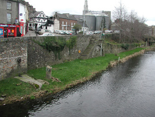
Description
Section of random rubble stone retaining wall, built 1820, with flight of twenty cut-stone steps leading to river bank (on segmental relieving arch with dressed rubble stone voussoirs, and random rubble stone infill), and dressed rubble stone (schist) vertical coping. Street fronted [SS].
Appraisal
Exhibiting a traditional construction in local fieldstone with 'refined' coping in a manner characteristic of the locality and the rural environs, a substantial retaining wall reputedly established by the trustees of the estate of the Earl of Portsmouth as part of a comprehensive river navigation improvement programme (see also 15603156 - 157) represents an important element of the urban landscape heritage of Enniscorthy with particular emphasis on the pleasing aspects from Enniscorthy Bridge (see 15603154) and the River Slaney.