
Survey Data
Reg No
15310154
Rating
Regional
Categories of Special Interest
Architectural, Historical, Social
Original Use
Gates/railings/walls
In Use As
Park
Date
1800 - 1810
Coordinates
243522, 253455
Date Recorded
20/07/2004
Date Updated
--/--/--
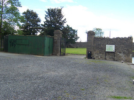
Description
Section of rubble limestone boundary walling associated with a former Royal Canal storage yard, erected c.1806. Now surrounds a public park with former stores now demolished. Main gateway to the west end through a pair of ashlar limestone gate piers (on square-plan) having moulded capstones over and supporting wrought-iron gates. Located adjacent to the north of the former Royal Canal (passenger) Harbour (15310150) and to the west of Scanlan's Bridge (15310151).
Appraisal
A robust section of rubble limestone boundary wall originally built by the Royal Canal Company in 1806, which adds historic interest to the north end of Mullingar and forms part of an important collection of structures associated with the former canal harbour. It originally contained a corn store, which was demolished in 1987. Of particular interest is the good quality gateway to the west side, which is well-built in fine stone masonry and is an attractive feature to the north of Mullingar. The interior space is now in use as a public park and is an important social amenity serving the local community.