
Survey Data
Reg No
15001038
Rating
Regional
Categories of Special Interest
Historical, Social
Original Use
Building misc
In Use As
Building misc
Date
1800 - 1840
Coordinates
202624, 241571
Date Recorded
08/09/2004
Date Updated
--/--/--
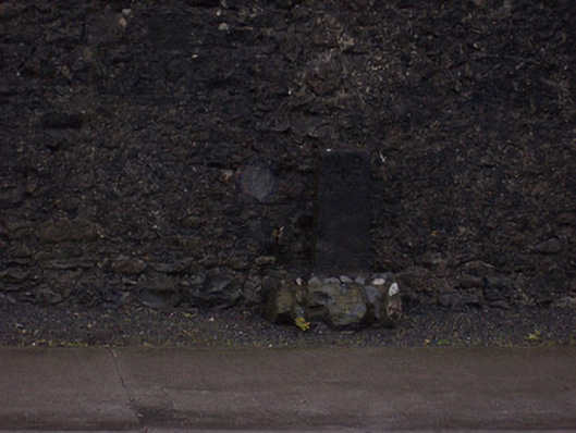
Description
Freestanding limestone ward boundary marker, erected c.1820, inscribed with 'WD' and 'No. 4' to front face (south). Probable Ordnance Survey benchmark to head. Located on footpath.
Appraisal
A subtle but interesting piece of street furniture. Ward boundary markers were erected in the early-to-mid nineteenth-century to identify the extent of territorial units/election constituencies for local government elections. The possible benchmark would date from the 1820s or 30s, when the Ordnance Survey was carrying out survey work in advance of the production of the first series of six-inch maps (Westmeath published in 1837-8).