
Survey Data
Reg No
13900421
Rating
Regional
Categories of Special Interest
Architectural, Technical
Original Use
Bridge
In Use As
Bridge
Date
1760 - 1800
Coordinates
308252, 314461
Date Recorded
02/08/2005
Date Updated
--/--/--
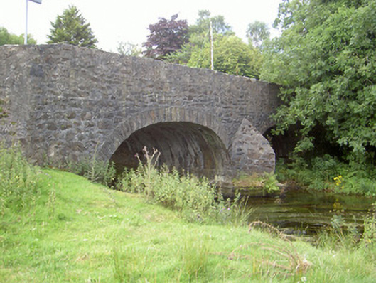
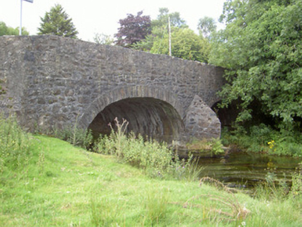
Description
Double-arch road-over-river bridge, built c. 1780. Random rubble stone walling to spandrels and parapet, roughly dressed stone coping to parapet, random rubble stone V-cutwaters to north and south. Roughly dress stone voussoirs to arches. Bitmac roadway travelling east-west carrying roadway over Flurry River, random rubble stone wall running to east protecting road from flood plain.
Appraisal
Curralhir Bridge, crossing the Flurry River, is an attractive bridge of traditional construction and forms an important component of the riverscape. The V-cutwaters, roughly dressed stone voussoirs and parapet and the long random rubble walling running to the east, protecting the road from the Flurry River flood plain, all add to the architectural detailing of the bridge which retains its original profile and form and is of a technical engineering interest.