


Survey Data
Reg No
13402707
Rating
Regional
Categories of Special Interest
Archaeological, Architectural, Technical
Original Use
Bridge
In Use As
Bridge
Date
1750 - 1800
Coordinates
218217, 256896
Date Recorded
27/07/2005
Date Updated
--/--/--
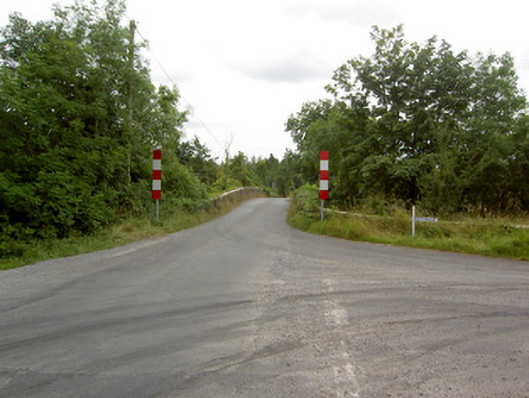
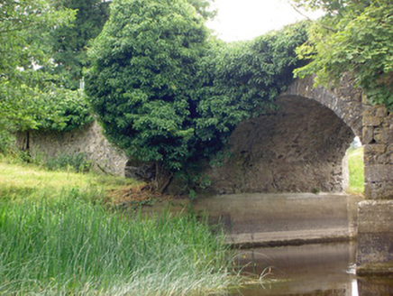
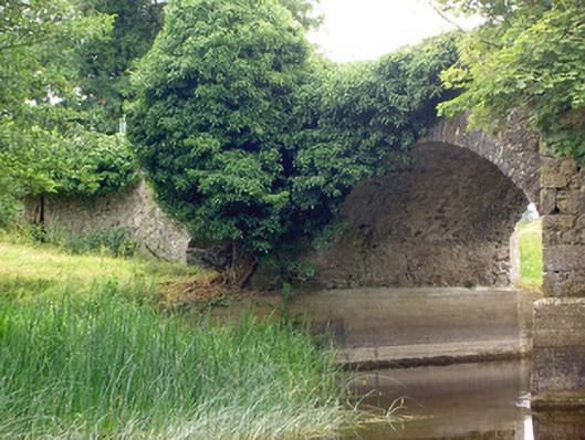
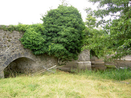
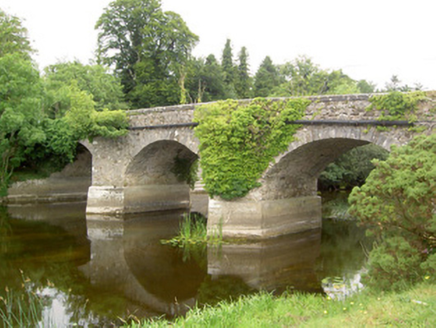
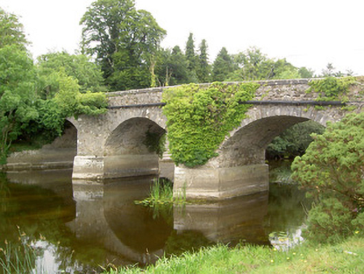
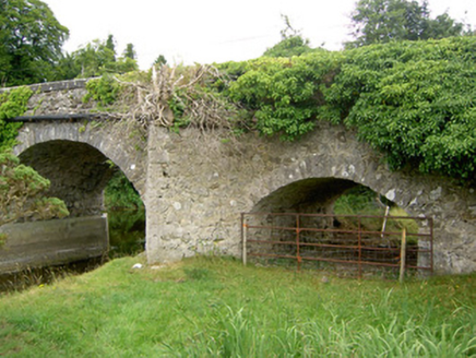
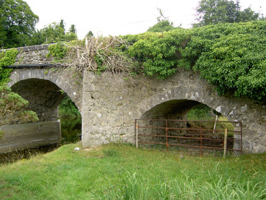
Description
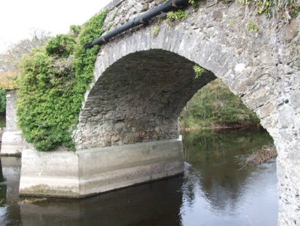
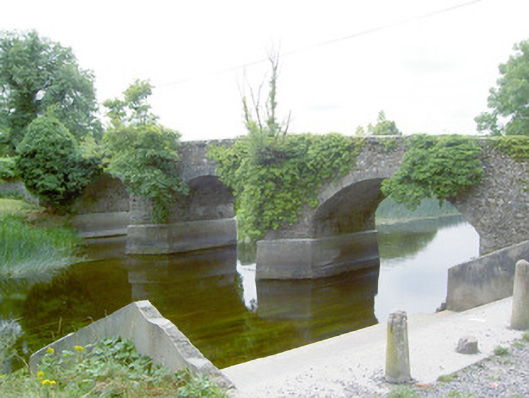
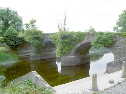
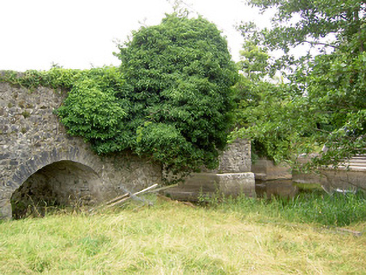
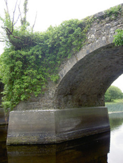
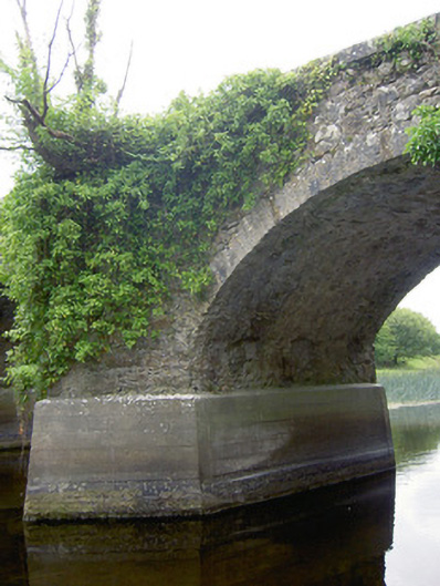
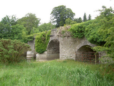
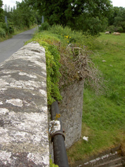
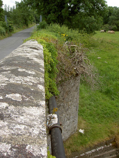
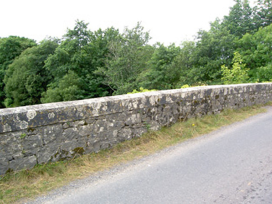
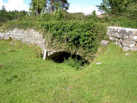
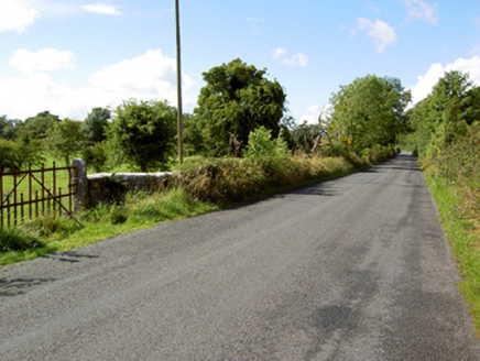
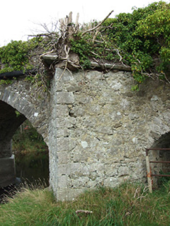
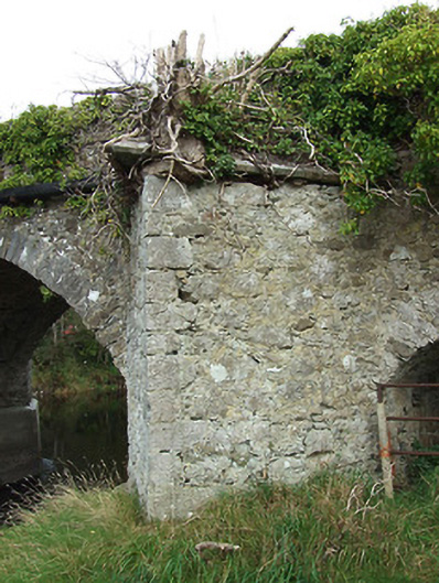
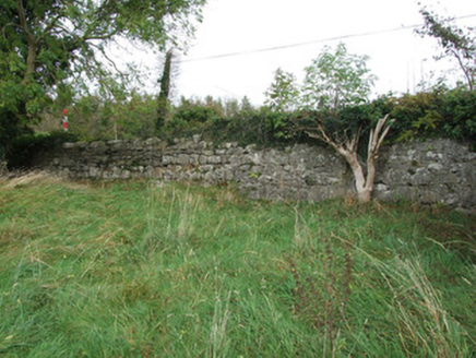
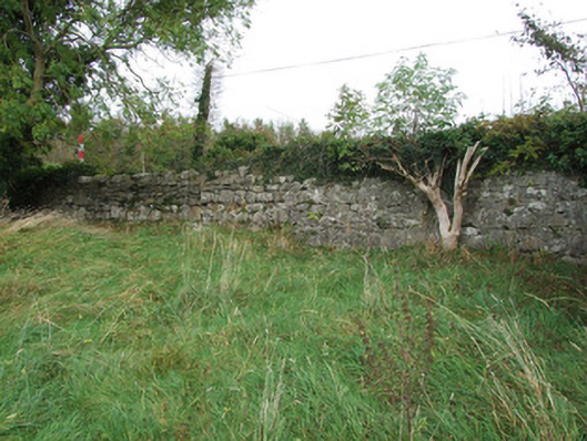
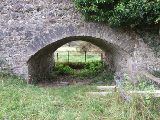
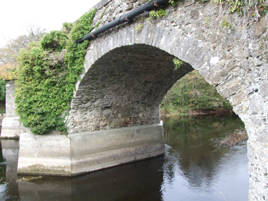
Four-arch road bridge over River Inny, built c. 1775. Arch to the southeast end of bridge constructed on a smaller scale and now over dry channel of river. Random rubble limestone construction to spandrels, piers, abutments, arch barrels and parapet walls. Some remaining sections of lime roughcast render. Segmental-headed arches with roughly dressed and squared limestone voussoirs. Rubble stone cutwaters to piers (on V-shaped plan) having roughly dressed limestone quoins. Chamfered dressed limestone coping over a number of the cutwaters. Rounded dressed ashlar limestone coping over parapet walls. Rubble stone wing walls to southeast ends of parapets. Vernacular gateway to the southeast end of parapet to the west, comprising a pair of roughly dressed limestone gate posts (on square-plan) having rounded heads and a wrought-iron gate. Located on the northwest boundary of the present Newcastle House demesne (13402709), and to the east of Ballymahon.
Appraisal
This fine road bridge retains its early character and form. The narrow-plan of this bridge suggests that it is quite early, perhaps dating to the mid-eighteenth century. The relatively broad span of the arches are of some engineering merit, particularly for their date of construction. The elegant form of this road bridge is enhanced by the textural variation of random rubble limestone construction with the roughly dressed limestone voussoirs to the arches and with the dressed limestone coping to the parapets. The impressive and robust cutwaters to both elevations of this bridge may originally have served as pedestrian refuges, later modified. The now disused arch to the southeast side of the bridge indicates that the River Inny was considerably wider (probably dredged c. 1860, and possibly at the same time nearby Abbeyshrule Bridge (13402347) was modified) at this point when it was originally constructed). The location of this bridge within the historic confines of the important Newcastle (13402709) estate hints that the Harman family may have been involved/funded its construction. The present bridge replaced an earlier wooden bridge at or close to this site, which was extant in 1682 (Nicholas Dowdall recorded ‘that Newcastle, the antient Estate of the Earl of Kildare, now the Estate and habitation of Robert Choppin Esqr where he hath lately built a fair house and a wooden bridge over the said River'). Choppin was also reputedly involved in the construction of the bridge at Abbeyshrule (Dowdall 1682). There is a bridge indicated here on Moll’s map of 1714 (‘A New Map of Ireland’) but it is unlikely that this is the present structure. A bridge is also depicted here on the later Taylor and Skinner road maps of 1777 – 1783. There are references to a ‘proposed bridge over the River Inny at Newcastle’ dated 1794, which was to be built for Lawrence/Laurence Parsons-Harman (1749 - 1807, 1st Viscount Oxmantown, to designs by John Sutherland (Irish Architectural Archive). Sutherland (1745 – 1826) was one of the most celebrated landscape architects in Ireland, and it is likely that these designs were for an ‘ornamental’ estate bridge rather than Newcastle Bridge itself (it may have been the bridge indicated over the River Inny to the north of Newcastle House on the 1913 map of the area, now demolished). This fine and imposing bridge is one of the most important structures of its type in County Longford, and is an attractive feature in the rural landscape to the east of Ballymahon.