


Survey Data
Reg No
13402611
Rating
Regional
Categories of Special Interest
Architectural, Artistic, Social
Original Use
House
In Use As
House
Date
1840 - 1880
Coordinates
213429, 255960
Date Recorded
11/08/2005
Date Updated
--/--/--
Description
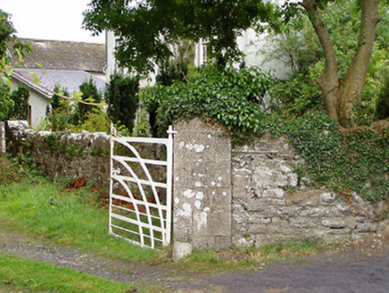
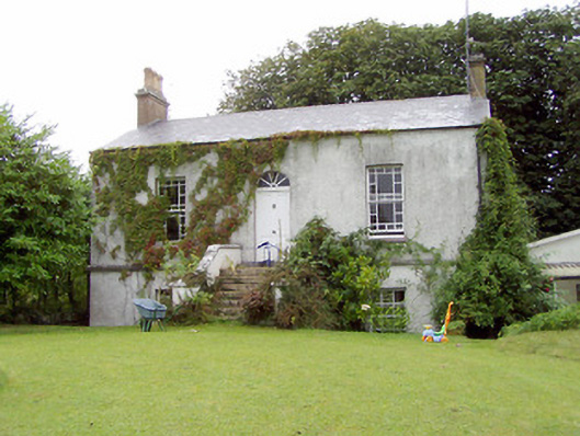
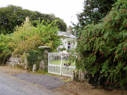
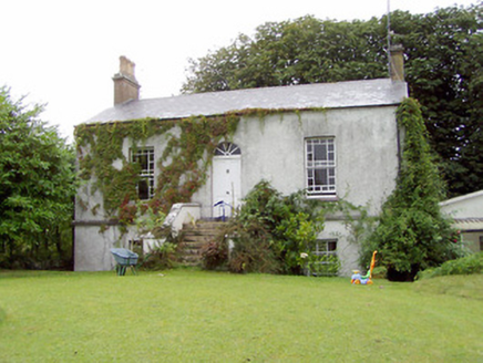
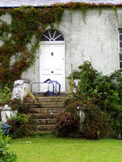
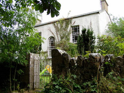
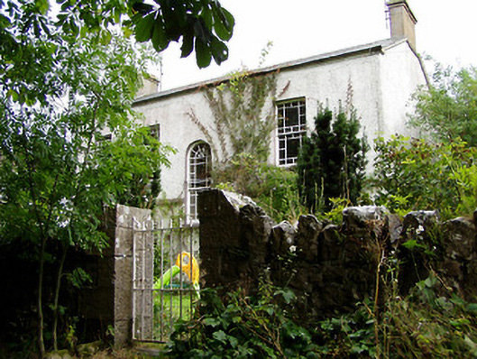
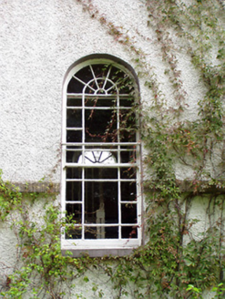
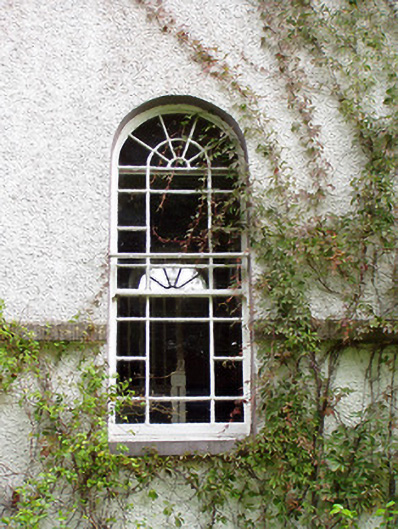
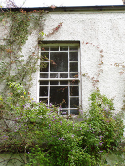
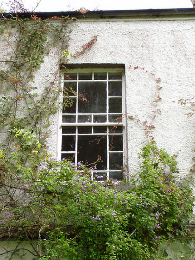
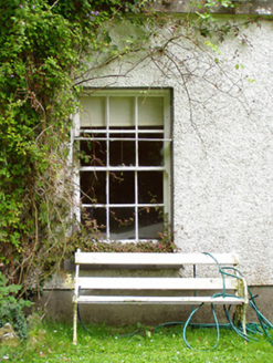
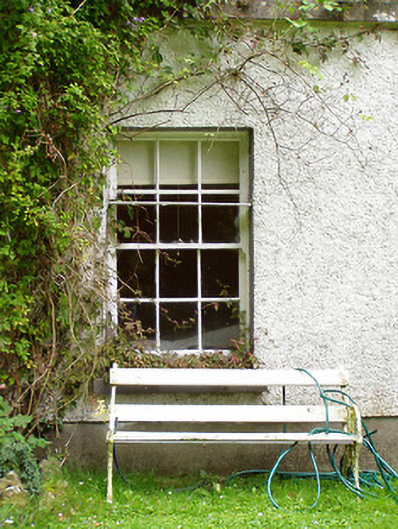
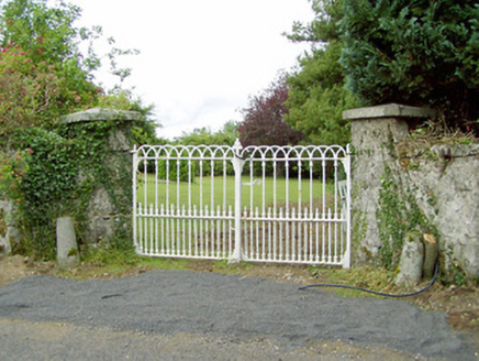
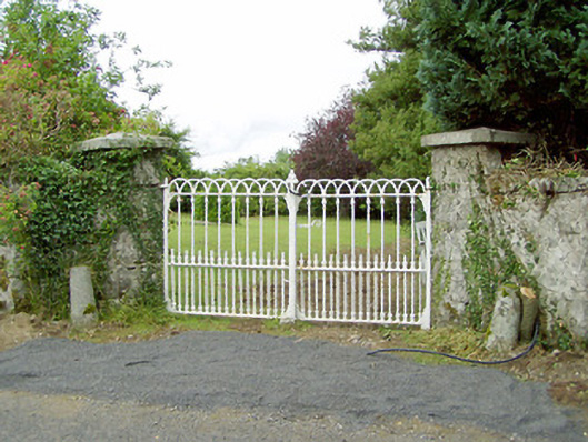
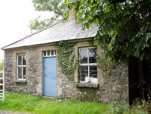
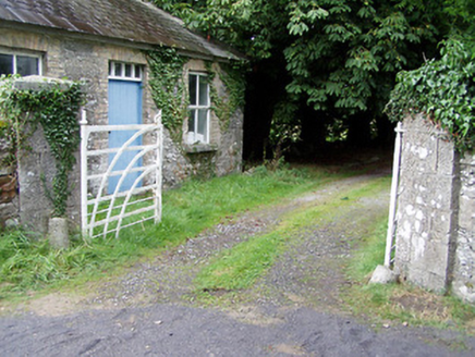
Detached three-bay single-storey over raised basement house, built c. 1860, possibly formerly in use as a miller’s house associated with Shrule Mills (13402612) adjacent to the east. Pitched natural slate roof with rendered chimneystacks to gable ends (east and west) having terracotta chimney pots. Some remaining cast-iron rainwater goods. Roughcast rendered walls with cut limestone string course between basement and first floor level. Square-headed openings with margin timber sliding sash windows to ground floor and six-over-six pane timber sliding sash windows to basement level, all with limestone sills. Round-headed window to rear, lighting stairwell, having spoked fanlight over margin timber sash sliding windows. Central round-headed opening to front elevation (south) with spoked fanlight and timber panelled door. Flight of limestone steps to entrance having rendered walls with limestone coping over. Set back from road in own grounds to the southwest of Ballymahon, located on island on the River Inny and adjacent to the northwest of former corn mill and flour mill (13402612). Detached three-bay single-storey former gate lodge to rear having hipped natural slate roof with cut stone eaves course and central rendered chimneystack. Coursed rubble limestone masonry walls with flush roughly dressed limestone quoins. Square-headed window openings with replacement casement windows having brick block-and-start surrounds and limestone sills. Central square-headed door opening to front elevation (south) with timber battened door, cut limestone step and with glazed overlight. Gateway to the south, serving front elevation of house, comprising a pair of ashlar limestone gate piers (on square-plan) having shallow pyramidal capstones and a pair of hooped wrought-iron gates with cast-iron finials. Gateway to the west/northwest, serving rear of house, having a pair of ashlar limestone gate piers (on square-plan) having shallow pyramidal capstones and a pair of wrought-iron flat bar gates with curving support bars. Coursed rubble stone boundary walls to road-frontage to the southwest, and to rear of site. Pedestrian gateway to the north of house comprising a pair of dressed ashlar limestone gate piers (on square-plan) having wrought-iron gate.
Appraisal
This attractive and well-proportioned building retains its original form, character and much of its early fabric. The form of this house, having raised basement with flight of steps to main doorway on the first floor, is of a type that is relatively common in the expanding mid-nineteenth century suburbs of the larger towns and cities in Ireland (particularly Dublin) but is rare in County Longford. The regular façade is enlivened by the doorway with its elegant spoked fanlight and by the distinctive and unusual timber sash windows. The rear of the house mirrors the arrangement of the main façade with a tall centrally-placed round-headed window with fanlight. The elegant flight of cut stone steps serving the main door adds a sense of grandeur and gives this building an strong presence that belies its relatively small size. The gate lodge to the west is an unusual feature to find at a house of this modest scale and adds considerably to the setting. The good quality gate piers and the ornate gates are attractive features that add aesthetic interest. This building, and associated elements, is an interesting feature in the rural landscape to the southwest of Ballymahon, and is an integral element of the built heritage of the local area. The location of this house, adjacent to the northwest of Shrule Mills (13402612) suggests that it may have been originally built by the owner of this impressive industrial complex. It appears to have been the home of a Nicholas Butler c. 1855, who leased the house from a William Henderson (Griffith’s Valuation). However, it may have been the home of Philip McGlynn who owned the adjacent mill c. 1855 (Valuations Office Mill Book). There is a building marked on this site in 1838 (Ordnance Survey first edition six-inch map) but the form and style of the house to site suggests that it was built or heavily altered sometime later.