

Survey Data
Reg No
13402360
Rating
Regional
Categories of Special Interest
Technical
Original Use
Canal overflow
In Use As
Canal overflow
Date
1810 - 1820
Coordinates
223053, 260065
Date Recorded
16/06/2009
Date Updated
--/--/--
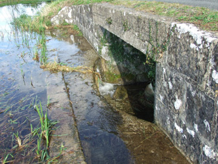
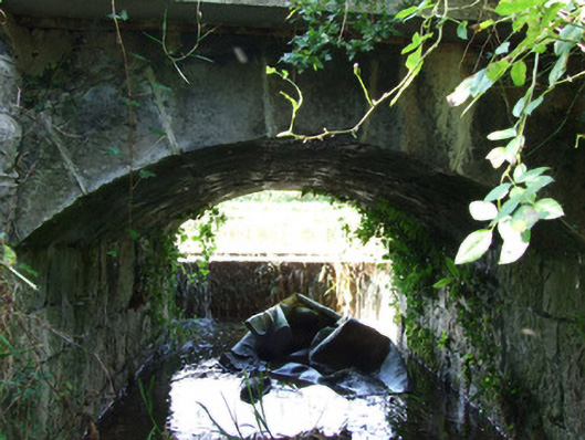
Description
Single-arch canal overflow associated with the Royal Canal (main branch), built c. 1817. Segmental-headed arch with dressed limestone voussoirs. Squared limestone rubble abutments, barrel and spandrels. Squared limestone retaining wall to the west, adjacent to canal. Concrete lintel/lintel repairs to the west elevation. Weir/overflow (on segmental-plan) to the west, adjacent to canal, having dressed limestone coping. Canal towpath over overflow. Located on the east bank of the Royal Canal adjacent to Scally’s Bridge (13402338), and to the north of Abbeyshrule.
Appraisal
This simple but well-built structure was originally constructed as a canal overflow associated with the Royal Canal (main branch). It was built to carry away excess water away from the canal and discharges it into the River Inny adjacent to the east. Although humble and utilitarian in form, this structure has an elegant and well-built arch and weir. The use of good quality masonry is testament to the attention to detail afforded to even the most mundane of features by the Royal Canal Company during the construction of the canal. This overflow is part of an extensive collection of canal-related structures in County Longford, and is an integral element of the built heritage of the area.