


Survey Data
Reg No
13402320
Rating
Regional
Categories of Special Interest
Architectural, Historical, Social
Previous Name
Castlewilder Police Barrack
Original Use
RIC barracks
Historical Use
Forge/smithy
In Use As
House
Date
1820 - 1840
Coordinates
223431, 261163
Date Recorded
01/09/2005
Date Updated
--/--/--
Description
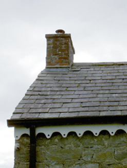
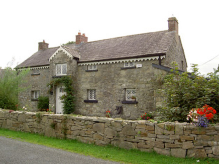
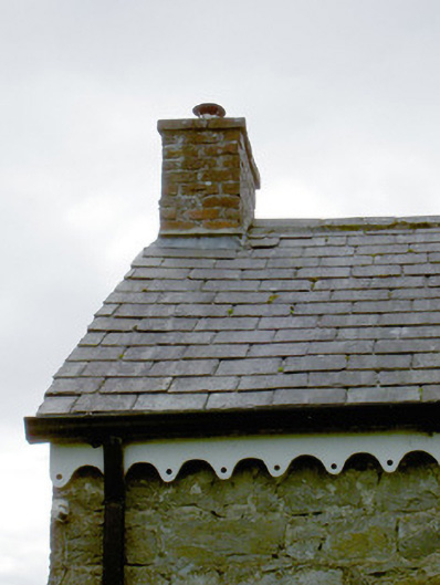
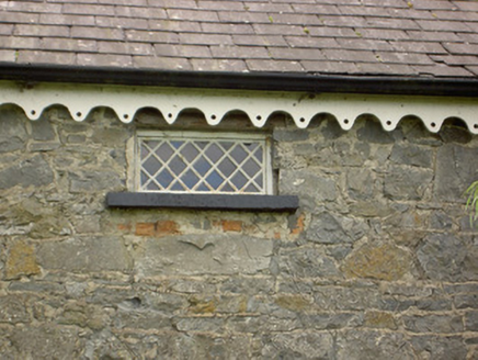
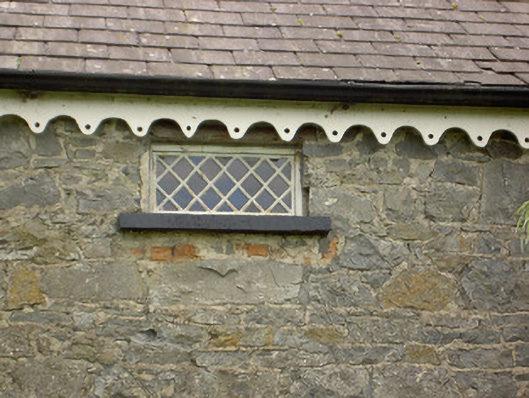
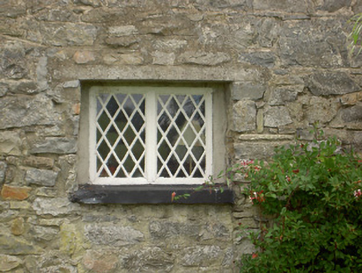
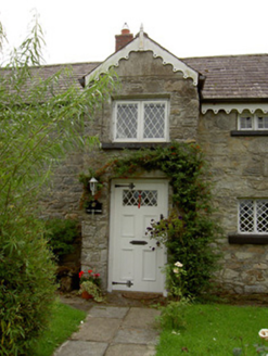
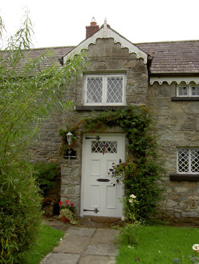
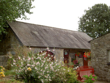
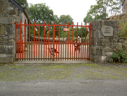
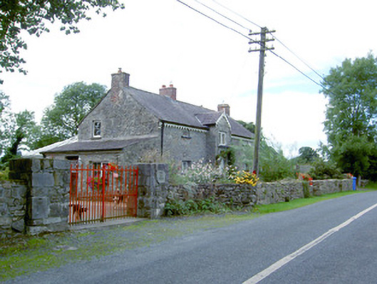
Detached four-bay two-storey former RIC barracks, built c. 1830, having single-bay gable-fronted breakfront to the offset to the southeast side of the main elevation (northeast) and with single-bay lean-to additions to the northeast and southwest gable ends. Formerly also in use as a forge/smithy, from c. 1860 until after c. 1913 (Ordnance Survey six-inch third edition map). Now in use as a private house. Pitched natural slate roof with three red brick chimneystacks, one to either gable end and one over projecting. Modern pierced timber bargeboards to main body of building, pierced timber bargeboards to breakfront having timber finial over gable apex. Rubble limestone walls, probably formerly rendered. Square-headed window openings having timber casement windows with lattice glazing bars and painted stone sills. Two square-headed window openings to the northwest end of the front elevation at first floor level having multiple-plan timber casement windows or two-over-two pane horizontal sliding sash windows. Square-headed door opening to breakfront with replacement timber and glazed door with lattice glazing. Outbuilding to southeast of site, possibly reconstructed on present site, having pitched natural slate roof and rubble limestone walls. Recessed section to the southwest end of front elevation of outbuilding (northwest) having overhanging roof and a square-headed window opening having timber casement windows with lattice glazing bars, and with square-headed door openings timber battened door. Segmental-headed carriage arch opening to northeast end of front elevation of outbuilding (northwest) having cut limestone voussoirs to arch and with double timber battened doors. Set slightly back from road in own grounds to the southwest of Legan and to the north of Abbeyshrule. Rebuilt rubble stone wall to road-frontage to the north. Main entrance gateway to the northeast having a pair of rebuilt rubble stone piers (on square-plan) and a pair of wrought-iron flat bar gates.
Appraisal
This interesting and quite picturesque building retains much of its early form and character. It also retains much of its early fabric including latticed glazed timber casement windows and a natural slate roof. The rubble stone construction to the main body of the building indicates that it was formerly rendered, but its removal fails to detract substantially form its appearance. A number of the ground floor window openings appear to have been formerly doorways, later partially infilled. This building is of historical and social importance as a former Royal Irish Constabulary barracks from c. 1830 (O’Donovan Letters c. 1835; Ordnance Survey six-inch first edition map 1837), and it is one of a number of former police barracks in the Abbeyshrule area (there was formerly a barracks in Abbeyshrule village, now demolished). It was later in use as a forge or smithy from c. 1860 (Griffiths Valuation records the site as a ‘house, forge and garden’ with John Kenny as the lessor and Michael Dowler, and Thomas and Margaret Dolan as residents) until the early decades of the twentieth century at the earliest (Ordnance Survey six-inch third edition map 1913). The carriage-arch to the outbuilding to the northeast end of the house suggests that this was probably the forge to site. However, this outbuilding may have been rebuilt on its present site from another location in recent years. The simple wrought-iron gates complete the setting of this charming composition, which is an integral element of the built and social heritage of the local area.