


Survey Data
Reg No
13402308
Rating
Regional
Categories of Special Interest
Architectural
Original Use
Walled garden
In Use As
Walled garden
Date
1760 - 1800
Coordinates
217923, 262988
Date Recorded
01/09/2005
Date Updated
--/--/--
Description
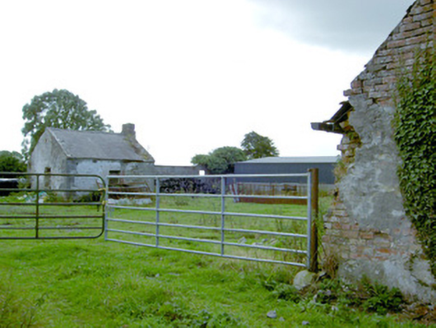
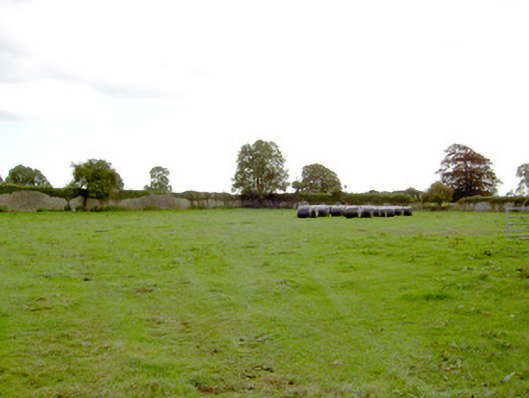
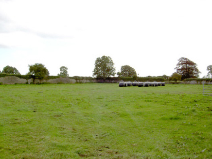
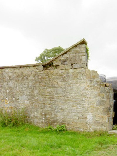
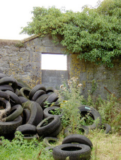
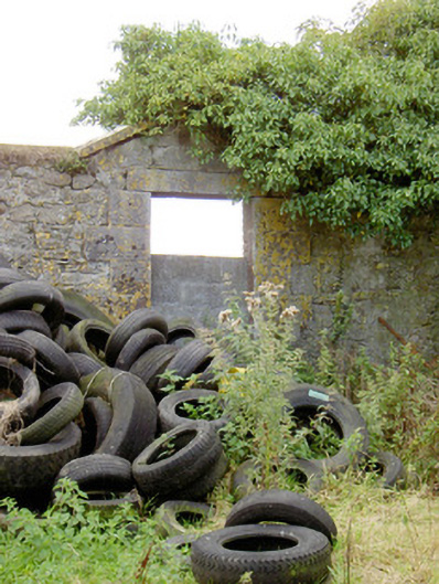
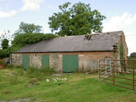
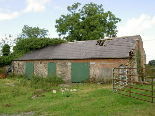
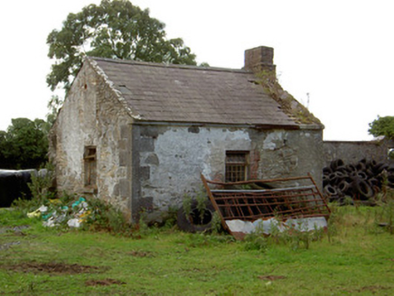
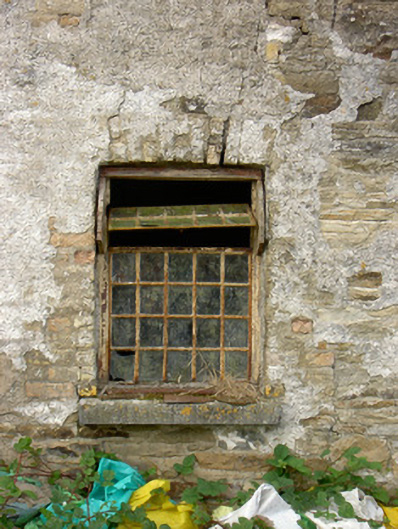
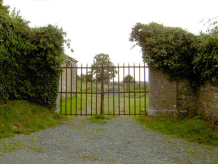
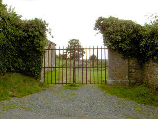
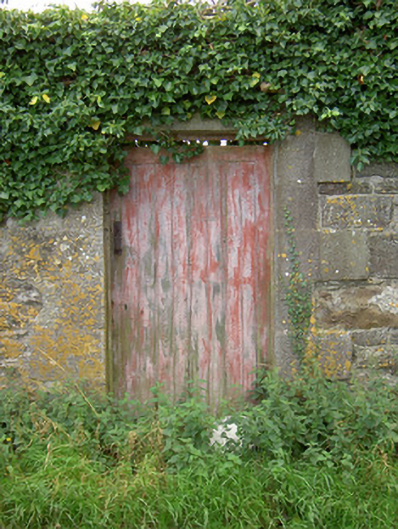
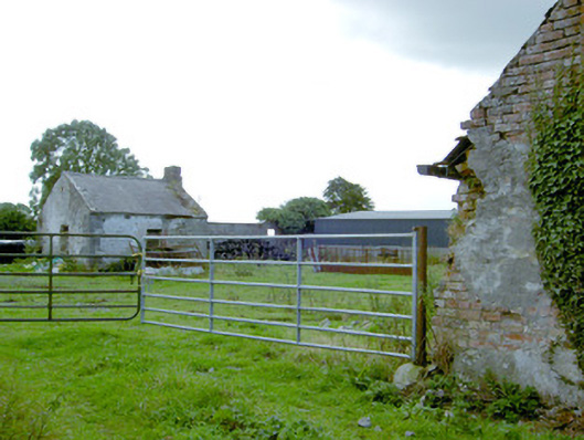
Former walled garden on square-plan, built c. 1780. Originally associated with Park Place House, now demolished, and located to the east of the site of the house. Rubble limestone and roughly dressed and squared limestone boundary walls to site having cut stone capstones over. Walls now largely overgrown. Square-headed integral pedestrian entrances having dressed limestone block-and-start surrounds with keystones and battened timber doors. Two detached single-storey outbuildings to the west, adjacent to site of house, comprising a five-bay outbuilding to the north and a single-bay outbuilding to the south. Pitched natural slate roofs; cut stone eaves course and brick chimneystack to outbuilding to the south. Roughcast rendered rubble stone construction to outbuilding to the south having dressed limestone quoins to the corners, and with square-headed window openings having red brick block-and-start surround with multi-paned metal pivoting windows and tooled limestone sills. Rubble stone and red brick walls to outbuilding to the north having square-headed openings with red brick surrounds and square-headed openings with modern corrugated-metal fittings. Main entrance gates to the north comprising a pair of dressed limestone gate piers (on square-plan) having chamfered plinths, moulded capstones and a pair of wrought-iron gates. Set back from road in own grounds to the northwest of Barry. Rubble limestone boundary walls to site.
Appraisal
This substantial walled garden was originally built to serve Park Place House, now demolished. The walled garden survives in relatively good condition and retains its early form and character. Although the main house has now been demolished the architectural detailing evident in the walled garden, such as the cut capping stones and the good quality dressed limestone block-and-start surrounds to the integral pedestrian gateways, indicates its association with a large country house of architectural design. The scale of the walled garden provides an interesting historical insight into the extensive resources required to run and maintain a middle-sized country estate in Ireland during the nineteenth century, and also acts as an historical reminder of the now demolished main house. It would have been originally used to grow a wide variety of produce for use in the main house. The simple outbuildings to the west of the garden survive in relatively good condition. Of particular note is the small-scale outbuilding to the north, which has good quality dressed limestone quoins to the corners, a natural slate roof and retains metal-framed pivoting window fittings to the openings. The robust gateway to the north of the site is well-built using good quality masonry and retains wrought-iron gates. This gateway adds substantially to the setting and completes this composition. Park Place House was the home of the Moffet family during the late-eighteenth and early-nineteenth century (A Revd. Robert Moffett (died 1819) lived here from about 1786). It was the residence of a John R. Robinson, Treasurer of the Grand Jury in Longford in 1837 (the Robinson family had their main seat at nearby Lisglassock House, and John Robinson may have moved back to Lissglassock following the death as his father, also John, in 1839). It was the residence of an Ambrose Bole from c. 1840 until 1903. Ambrose Bole J.P. (1812 – 1903), described as land agent to the Ballymahon Estate – probably King Harman family of Newcastle House) in 1846, 1881 and 1894(Slater’s Directory). Bole also acted as a land agent to the Shuldam family of Moigh/Moygh House to the southwest of Ballymahon from c. 1850.