Survey Data
Reg No
13401502
Rating
Regional
Categories of Special Interest
Architectural
Original Use
Demesne walls/gates/railings
Date
1780 - 1820
Coordinates
229550, 277093
Date Recorded
04/08/2005
Date Updated
--/--/--
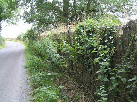
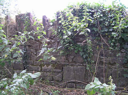
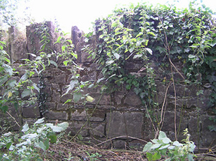
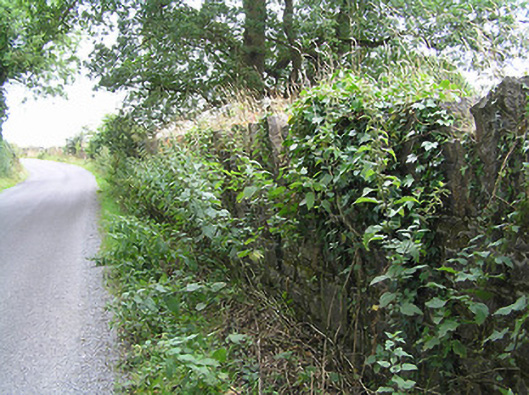
Description
Sections of roughly dressed stone boundary walls, built c. 1800, having crenellated coping over. Formerly associated with house/farmyard at Tully. Aligning road to the southwest of Granard and to the northeast of Edgeworthstown.
Appraisal
This simple but well-built boundary wall acts as an historical reminder of the former Tully estate. The crenellated coping provide a sense of strength and add interest along the roadscape. This unassuming boundary wall is an interesting feature in the rural landscape to the southwest of Granard, adding visual appeal and historic incident to the local area. It forms an interesting pair of related structures with the group of outbuildings (not visited) to the west. The lands of Tully have historical associations with the Newcomen family of Carrigglas Manor (13401414) and/or Mosstown House, Keenagh (now demolished). Thomas Newcomen was granted the lands of Tully in 1732 and it was the residence of a Stewart Bart (Baronet?), c. 1780 (Taylor and Skinner map 1777 – 1783), a relative of the Newcomen family of (probably of Mosstown, near Keenagh). It also appears to have historical associations with the Wilson (a Francis Wilson is mentioned as owning this land in 1737) and Bond families (it was inherited by James Wensley Bond, of Cartroncar House during the early-nineteenth century). The house/castle (LF015-016---- ) itself was demolished by 1838 (Ordnance Survey first edition six-inch map), and ‘only some old walls remained’ in 1836 – 7 (Ordnance Survey letters). The castle itself was in existence in1621 Fergus Farrall [Farrell] was granted ‘the castle and lands of Tully’.