


Survey Data
Reg No
13401450
Rating
Regional
Categories of Special Interest
Architectural
Previous Name
Oldtown
Original Use
Outbuilding
In Use As
Outbuilding
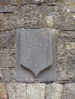
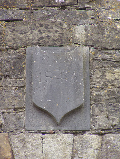
Date
1840 - 1850
Coordinates
220092, 271484
Date Recorded
27/07/2005
Date Updated
--/--/--
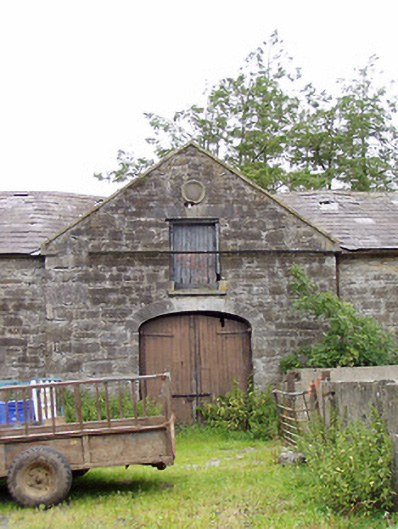
Description
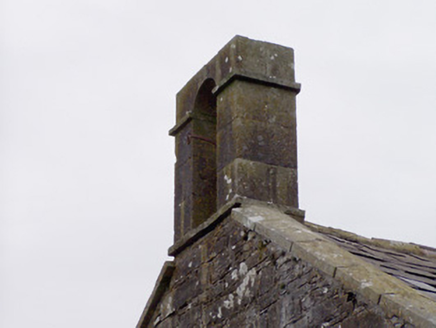
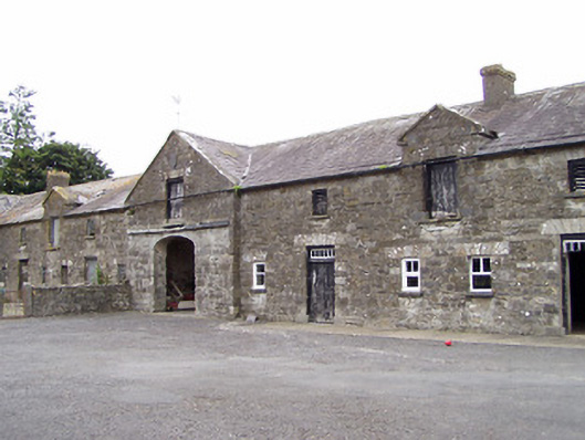
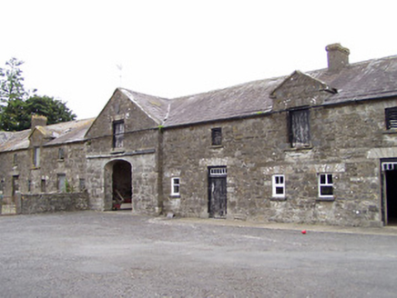
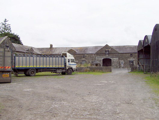
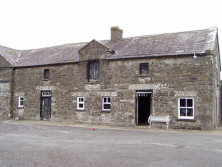
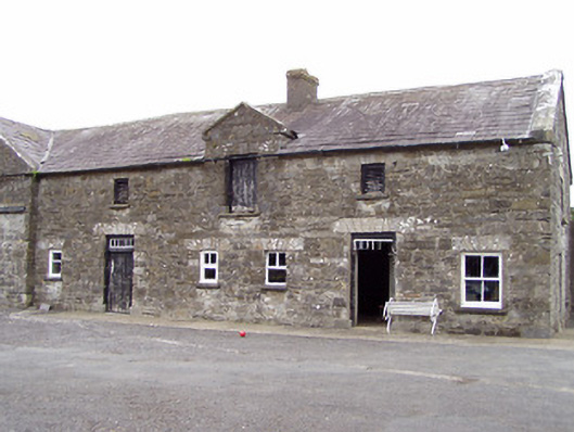
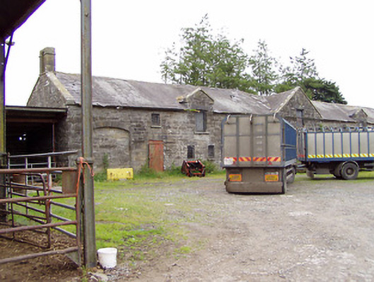
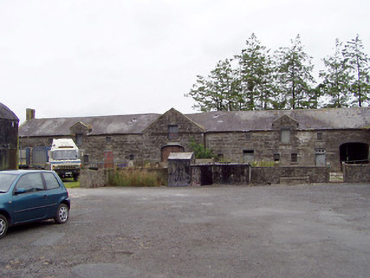
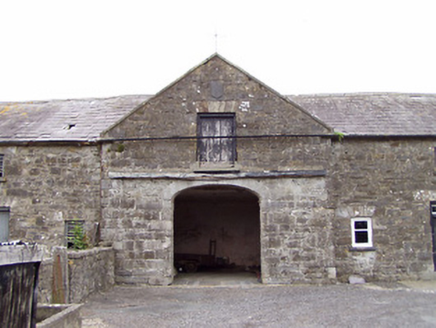
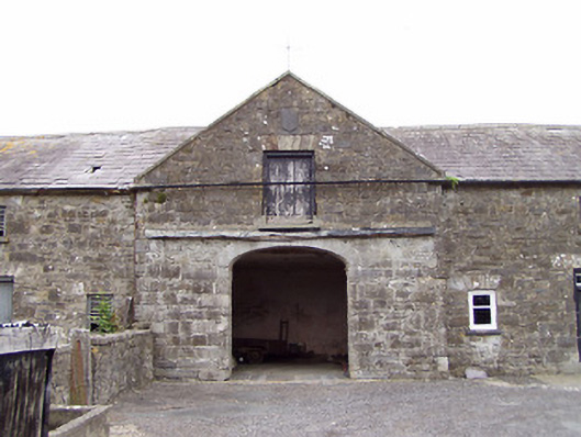
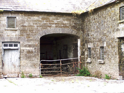
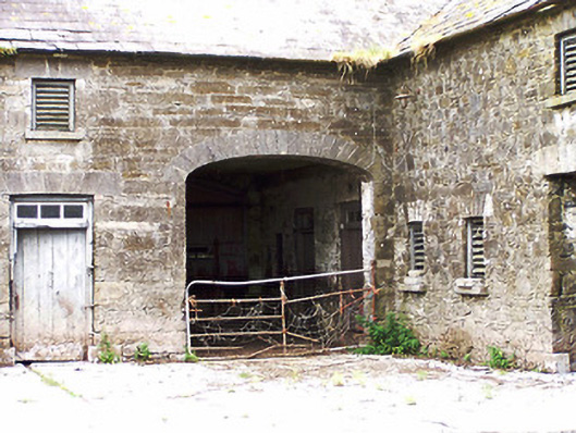
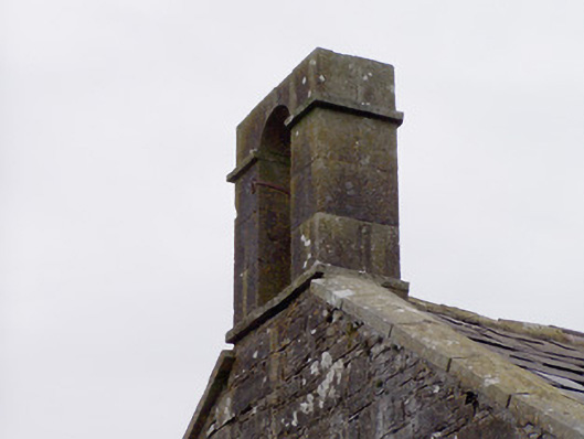
Complex of two-storey outbuildings on L-shaped plan associated with Oldtown House (13401451), built c. 1845, arranged around a courtyard to the rear (northwest)) of the main house. Multiple-bay two-storey range to the northeast having central pedimented breakfront, and multiple-bay two-storey range to the northwest having central pedimented breakfront. Pitched natural slate roofs with rendered chimneystacks, raised cut stone verges to gable ends, and cast-iron rainwater goods. Two half dormer openings to each range, one to either side of breakfront. Cut stone coping to dormers and pedimented breakfronts, wrought-iron finals over pedimented breakfronts. Ashlar limestone bellcote to the southwest end of range to the northwest having round-headed opening. Coursed squared limestone rubble and squared rubble stone walls with flush roughly dressed quoins to corners. Carved limestone date plaque to gable apex of pedimented breakfront range to the northeast, carved limestone roundel motif to gable apex of pedimented breakfront range to the northwest. Square-headed window openings with dressed limestone voussoirs, limestone sills and timber louvered fittings. One-over-one pane, two-over-one pane and four-over-four pane timber sliding sash windows to range to the northeast at ground floor level, to the southeast end of range window openings. Square-headed loading bays to dormers with timber battened doors and with dressed voussoirs over. Square-headed door openings having timber battened doors with glazed multi-paned overlights and with dressed voussoirs over. Segmental-headed carriage arch to breakfronts, and to end bays (southwest and northwest) of range to the northwest with dressed limestone voussoirs. Timber battened double-doors to carriage arch to breakfront to the northwest range, carriage arch to the southwest end of range to the northwest now infilled with rubble stone masonry. Rubble stone boundary walls and gateways having cut limestone gate posts and wrought-iron gates to site. Located in extensive mature grounds to the north of Ardagh, with shared grounds with Oldtown House (13401451).
Appraisal
This substantial complex of outbuildings was built to serve Oldtown House (13401451), and retain their early form and character. Although of quite simple construction, these outbuildings are given a classical architectural character by the central pedimented breakfronts to both ranges. This classical element lends these buildings a sense of grandeur and compliments the late-Georgian architecture of the main house to the southeast. The scale of these outbuildings provides an interesting historical and social insight into the extensive resources required to run and maintain a country estate in Ireland during the mid-to-late nineteenth century. The bellcote, and the roundel motif and the (helpful) date plaque to the central breakfronts adds additional interest and are modest examples of the skill of nineteenth century craftsmanship. The timber sliding sash windows to the southwest end of the northeast range hints that this building may have been in use as estate workers accommodation, although they may be later additions. The range to the northwest may have been built after the northeast range was constructed (hints in the stonework). The outbuildings are of apparent architectural design and quality, and form a pair of related structures with the house itself. They are an important element of the built heritage of Longford, adding architectural and historic appeal to the rural countryside to the north of Ardagh. The range to the northeast may have been remodelled c. 1845 as a range of outbuildings is indicated here on a 1838 map of the area (Ordnance Survey first edition six-inch map 1838). This house was formerly associated with the Gregg family. The Gregg family originally settled at Rathallard (now Oldtown?), Longford, in 1688, suggesting that the present house may occupy (or be close to) the site of a much earlier house (a house on narrower-plan is indicated at this site in 1838 - Ordnance Survey first edition six-inch map). A James Gregg of Oldtown was High Sheriff of Longford in 1809, and was later the residence of a Thornton Gregg in 1824 (Pigot’s Directory) and 1837 (Lewis Topographical Dictionary). It was described as ‘the property of Mr. Gregg’ with ‘ a large garden and extensive out offices’ in 1838 (Ordnance Survey Letters) and may have been in the ownership of a Rev. Thomas Gregg c. 1870.