


Survey Data
Reg No
13401021
Rating
Regional
Categories of Special Interest
Architectural, Technical
Original Use
Bridge
In Use As
Bridge
Date
1840 - 1880
Coordinates
227107, 279346
Date Recorded
24/08/2005
Date Updated
--/--/--
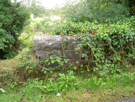
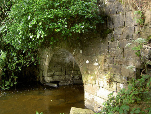
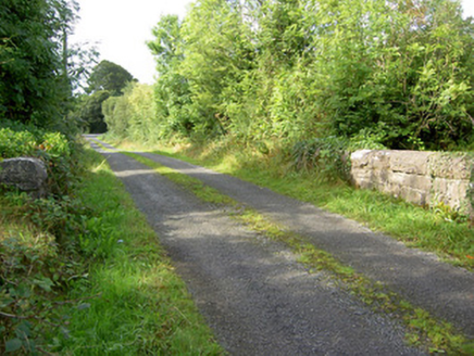
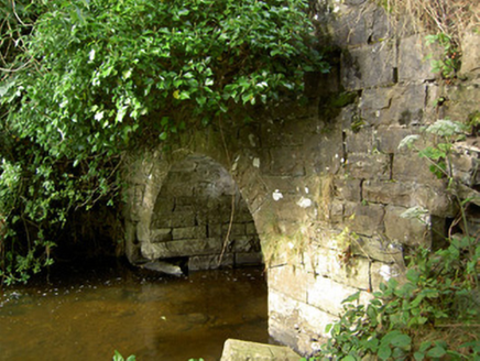
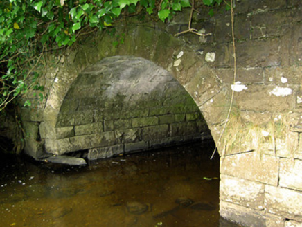
Description
Single-arch road bridge over tributary of Camlin River, built c. 1860. Segmental-headed arch with rock-faced voussoirs and having squared rubble stone construction to abutments and barrel. Dressed coursed squared rock-faced ,masonry construction to spandrel walls. Coursed rock-faced parapets with dressed limestone coping over. Parapet walls curve outwards (away from road) to either side with dressed rock-faced piers (on square-plan) to either side having dressed capstones over. Pier to the southwest end of parapet to the west now collapsed. Located along approach avenue to Cloonfin/Clonfin House (demolished). Located to the southwest of Granard.
Appraisal
A robustly-built small-scale bridge, of mid nineteenth-century appearance, which is a pleasing feature in the rural landscape to the southwest of Granard. Although the western parapet is now slightly damaged, it survives in relatively good condition. The simple elegant form of this road bridge is much enhanced by the textured rock-faced limestone detailing. Spanning a relatively small length, this bridge is a reminder of the pride and craftsmanship employed in such endeavors in the nineteenth century. The good quality rock-faced masonry is a typical feature of the many bridges built throughout Ireland by the Board of Works/Office of Public Works during the mid-to-late nineteenth century, and particularly between c. 1847 - 60, suggesting that they may have been responsible for its construction. However, this bridge is located along a former approach avenue to Cloonfin/Clonfin House, which hints that it may have been built or rebuilt as an estate bridge by the Thompson family. The elegantly curved parapets and the terminating piers have a higher aesthetic quality than is normally encountered with such small-scale bridges, perhaps hinting at the involvement of the habitants of Cloonfin/Clonfin House in its construction. The present structure replaced an earlier bridge to this site (Ordnance Survey first edition six-inch map 1838), and possibly incorporates fabric from this earlier structure.