


Survey Data
Reg No
13400906
Rating
Regional
Categories of Special Interest
Architectural, Technical
Original Use
Bridge
In Use As
Bridge
Date
1850 - 1870
Coordinates
221324, 280169
Date Recorded
05/08/2005
Date Updated
--/--/--
Description
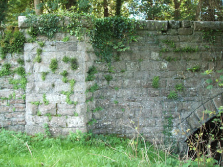
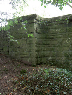
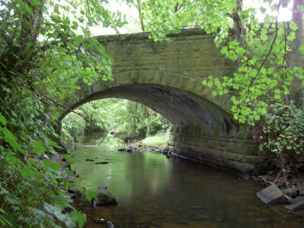
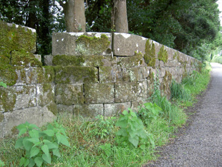
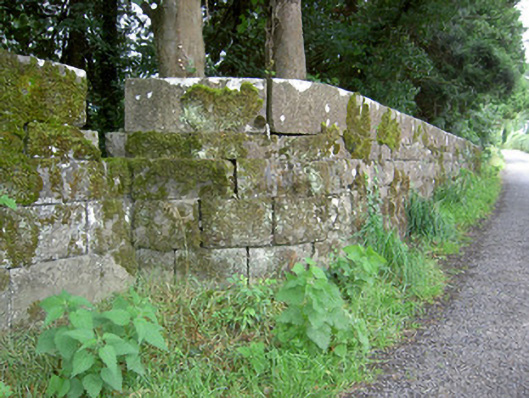
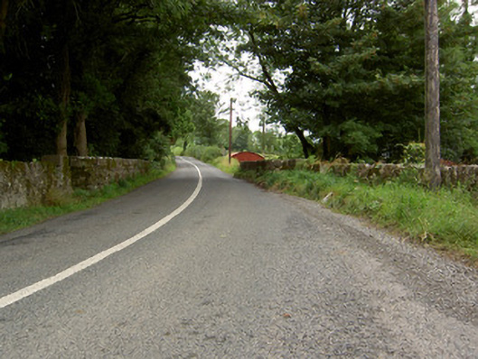
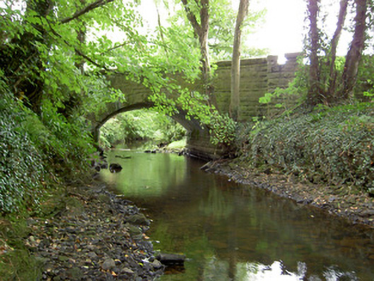
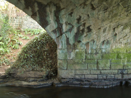
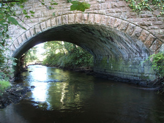
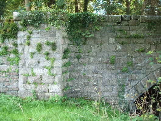
Single-arch road bridge over the Camlin River, built c. 1860. Segmental-headed arch with rock-faced limestone voussoirs with dressed edges. Squared and coursed rock-faced limestone spandrel walls and abutments. Squared and coursed rock-faced limestone masonry to parapets having dressed limestone coping over. Squared and coursed rock-faced piers (on square-plan having curved edges/quadrant profile to arch side) to either side of arch (east and west). Squared and dressed limestone masonry to barrel, laid diagonally perpendicular to voussoirs (bridge crosses river at a skewed angle). Random stone squared wing walls to either end of parapets. Located to the west of Ballinalee.
Appraisal
A robustly-built medium-scale bridge, of mid nineteenth-century appearance, which is a pleasing feature in the rural landscape to the west of Ballinalee. This bridge shows evidence of highly skilled craftsmanship in its stonemasonry, particularly to the voussoirs, the diagonally-laid stonework to the barrel, and to the parapets. The architectural form of the bridge is further enhanced by the curving parapet walls forming terminating piers to either side of the arch. The wide arch, and the skewed angle that this bridge crosses the Camlin, helps to add additional technical and engineering merit. The good quality rock-faced masonry is a typical feature of the many bridges built throughout Ireland by the Board of Works/Office of Public Works during the mid-to-late nineteenth century, and particularly between c. 1847 - 60, suggesting that they may have been responsible for its construction. This bridge is quite similar in form to Ballinkenny Bridge (13400816), which crosses the Camlin Rover further to the west, and may have been built at the same time as part of a general drainage and/or bridge building programme. The present structure replaced an earlier multiple-arched bridge with cutwaters at this site (Ordnance Survey first edition six-inch map 1838). The random rubble wing walls to either side of this bridge probably retain fabric from this earlier bridge.