
Survey Data
Reg No
12800501
Rating
Regional
Categories of Special Interest
Architectural, Technical
Original Use
Folly
In Use As
Folly
Date
1735 - 1745
Coordinates
254400, 210324
Date Recorded
17/08/2004
Date Updated
--/--/--
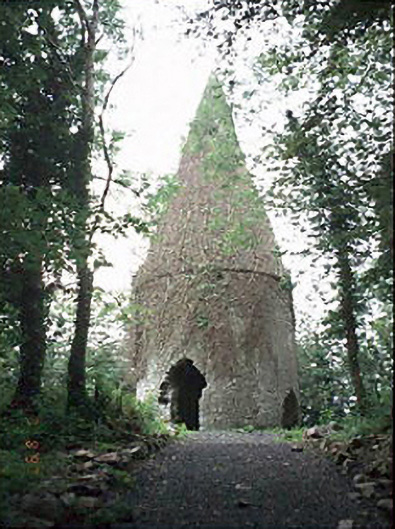
Description
Freestanding single-bay two-stage folly, built 1740, on a circular plan. Part repointed coursed rubble stone conical roof. Part repointed coursed rubble stone walls retaining sections of rendered surface finish. Destroyed pointed-arch or pointed segmental-headed opposing door openings with remains of buff brick block-and-start surrounds. Blind lancet loops (second stage). Set in wood on hill. NOTE: Erected by William Henry Dawson (1712-79) 'to give employment to the poor in the year of the great frost [1740]' (Coote 1801, 136). The folly was illustrated and labelled as "Spirehill" by Taylor and Skinner (1778, 159) and was later depicted in an idealised pastoral setting in a lithograph (1852) by William C. Forster (d. c.1911) of Dublin [NLI ET C328].