

Survey Data
Reg No
12403207
Rating
Regional
Categories of Special Interest
Architectural, Technical
Previous Name
Kilmacshane Bridge
Original Use
Bridge
In Use As
Bridge
Date
1815 - 1835
Coordinates
261744, 139143
Date Recorded
07/12/2004
Date Updated
--/--/--
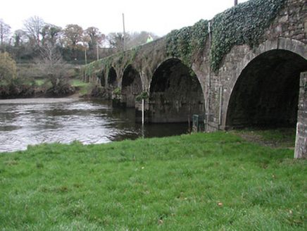
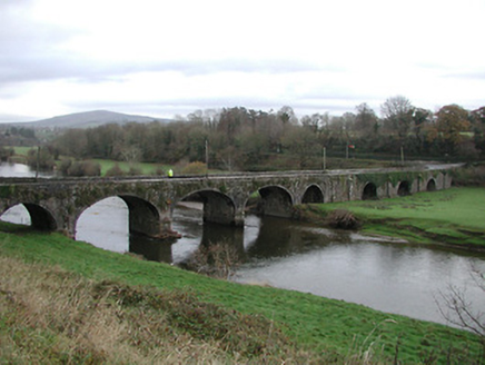
Description
Eight-arch rubble limestone road bridge over river and flood plain, c.1825. Random squared rubble limestone walls with cut-limestone triangular cut-waters to piers to north-west, squared rubble limestone tapered buttress pier to centre, dressed limestone buttress piers to south-east, and dressed limestone coping to parapets. Series of three elliptical arches with single round flanking arches, series of three round arches to south-east having limestone ashlar voussoirs incorporating keystones, and squared rubble limestone soffits having remains of unpainted render over. Sited spanning River Nore with grass banks to river including flood plain to south-east.
Appraisal
Making a dramatic visual statement in the River Nore valley a substantial road bridge represents an important element of the early nineteenth-century civil engineering legacy of County Kilkenny. Representing two distinct sections producing a cohesive whole as identified by the careful grouping of the arches over the river and the associated flood plain the bridge exhibits a traditional construction in barely-refined locally-sourced stone with dressed details exhibiting high quality stone masonry.