Survey Data
Reg No
12400918
Rating
Regional
Categories of Special Interest
Architectural, Technical
Original Use
Bridge
In Use As
Bridge
Date
1700 - 1839
Coordinates
243732, 168558
Date Recorded
01/01/2005
Date Updated
--/--/--
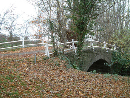
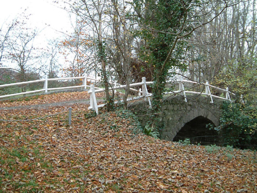
Description
Single-arch hump back bridge over river, extant 1839. Part creeper- or ivy-covered coursed rubble stone walls with dwarf parapets supporting timber fences. Single Tudor arch with rough cut limestone voussoirs. Sited spanning Grange River in landscaped grounds shared with Grange House.
Appraisal
A bridge contributing positively to the group and setting values of the Grange House estate with the architectural value of the composition confirmed not only by the rough cut stone work, but also by the "pointed" profile of the arch making a picturesque visual statement at a crossing over a stream-like tributary of the River Nore.