

Survey Data
Reg No
12327010
Rating
Regional
Categories of Special Interest
Architectural
Original Use
Farmyard complex
In Use As
Farmyard complex
Date
1815 - 1835
Coordinates
247546, 119075
Date Recorded
05/07/2004
Date Updated
--/--/--
Description
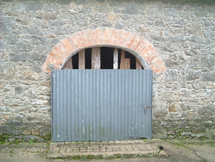
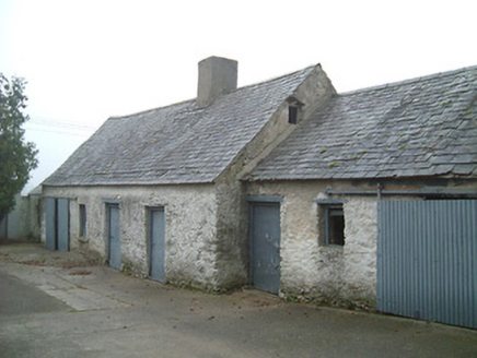
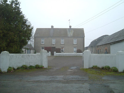
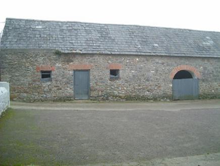
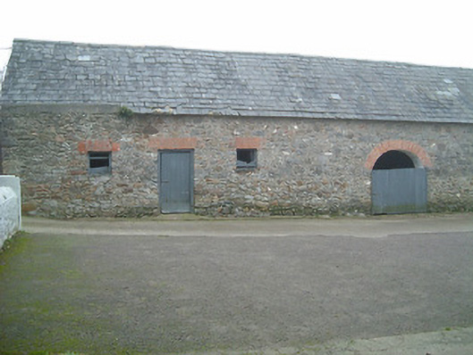
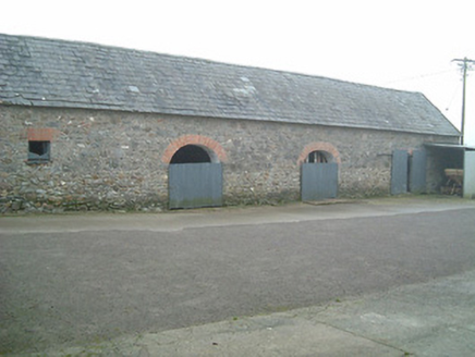
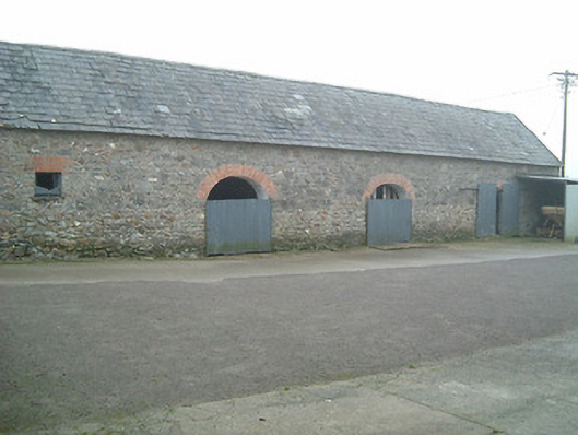
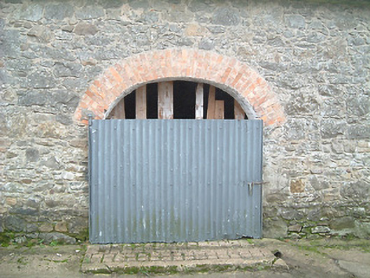
Farmyard complex, c.1825, about a courtyard including: (i) Detached four-bay two-storey farmhouse. Refenestrated. Pitched slate roof with clay ridge tiles, rendered chimney stacks, rendered coping, and iron rainwater goods on rendered eaves. Unpainted roughcast walls with rendered quoined piers to corners. Square-headed window openings with cut-stone sills, and replacement uPVC casement windows. Square-headed door opening with replacement timber panelled door having overlight. Set back from road with forecourt. (ii) Detached four-bay single-storey outbuilding with attic to north with square-headed carriageway to left, and three-bay single-storey recessed wing to right having square-headed carriageway. Pitched slate roofs with clay ridge tiles, rendered chimney stacks, and no rainwater goods on rendered squared rubble stone eaves. Painted (limewashed) random rubble stone walls. Square-headed window openings with no sills, timber lintels, and timber fittings. Square-headed door openings with timber lintels, and timber doors. Square-headed carriageways with painted replacement corrugated-iron doors, c.1975. (ii) Detached six-bay single-storey rubble stone outbuilding to south with series of three elliptical-headed carriageways to right. Pitched slate roof with clay ridge tiles, and no rainwater goods on squared rubble stone eaves. Random rubble stone walls. Square-headed window openings with no sills, red brick voussoirs, and timber fittings. Square-headed door opening with red brick voussoirs, and timber boarded door. Series of three elliptical-headed carriageways to right with red brick voussoirs, and painted replacement corrugated-iron doors, c.1975.
Appraisal
An attractive group of agricultural buildings arranged about a courtyard forming part of a cluster of small-scale farm holdings that historically made up much of the settlement of Turkstown: archival editions of the Ordnance Survey illustrate a pattern of farmyards flanking the road leading to Mooncoin to the south-east. Despite the insertion of inappropriate replacement fittings to the openings much of the character of the farmhouse prevails while a collection of attendant outbuildings exhibiting unrefined stone work introduces an appealing element of some vernacular quality to the group.