
Survey Data
Reg No
12001104
Rating
Regional
Categories of Special Interest
Architectural, Social
Original Use
Handball alley
In Use As
Handball alley
Date
1890 - 1910
Coordinates
250574, 155328
Date Recorded
17/06/2004
Date Updated
--/--/--
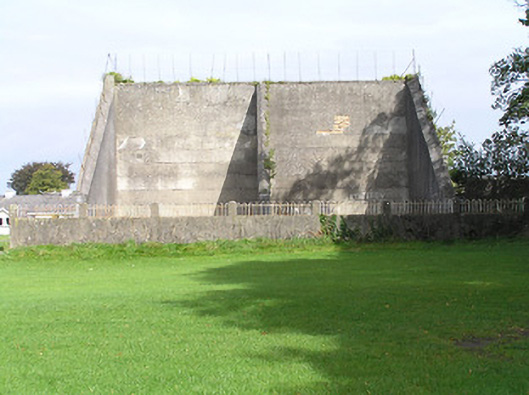
Description
Archival Description [Demolished 2005]: Pair of freestanding handball alleys, extant 1871, on rectangular plans with repointed coursed rubble limestone stepped boundary walls terminating in tooled limestone ashlar piers; rendered, ruled and lined yellow brick English Garden Wall bond surface finish to courts. Set in grounds shared with Saint Kieran's College.
Appraisal
Archival Appraisal [Demolished 2005]: A pair of handball alleys contributing positively to the setting of the Saint Kieran's College complex.