

Survey Data
Reg No
11901402
Rating
Regional
Categories of Special Interest
Architectural, Scientific, Technical
Original Use
Bridge
In Use As
Bridge
Date
1773 - 1784
Coordinates
285436, 224607
Date Recorded
14/10/2002
Date Updated
--/--/--
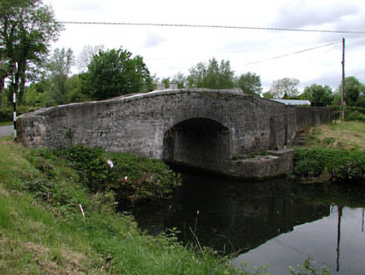
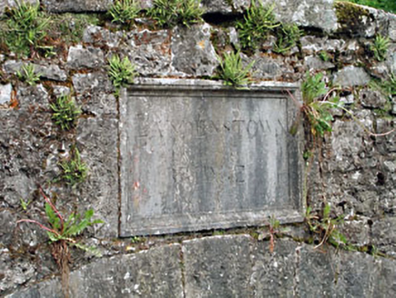
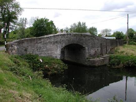
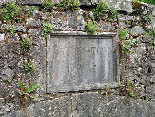
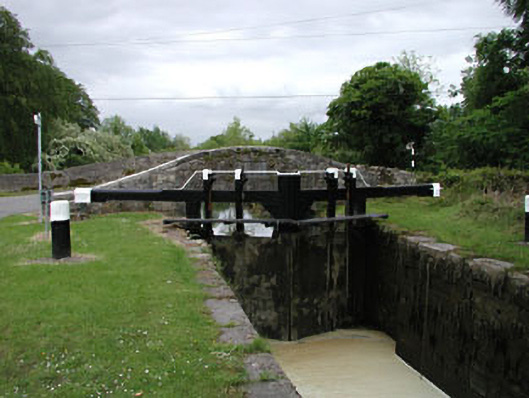
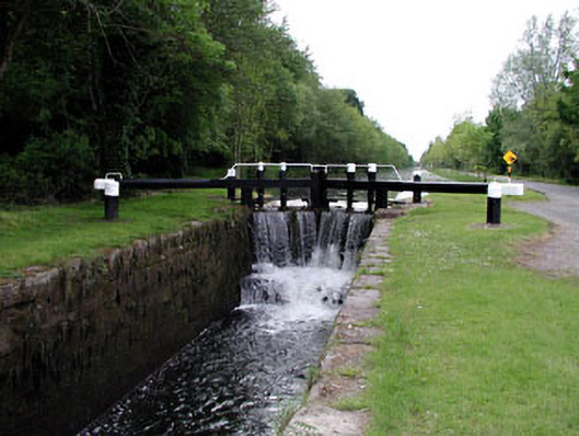
Description
Single-arch hump back bridge over canal, opened 1784. Part repointed rubble limestone walls with cut-granite coping to parapets. Single segmental arch below inscribed drag edged cut-limestone panels with tooled limestone ashlar voussoirs. Sited spanning Grand Canal with retaining walls to lock having benchmark-inscribed cut-granite rounded coping supporting pairs of timber gates.
Appraisal
A bridge representing an important component of the civil engineering heritage of County Kildare with the architectural value of the composition confirmed not only by the blue-grey limestone dressings demonstrating good quality workmanship, but also by the elegant "sweep" of the arch making a pleasing visual statement at a crossing over the Sallins to Robertstown extension of the Grand Canal opened (1784) by the Grand Canal Company (incorporated 1772). NOTE: Queries from the Company of Undertakers of the Grand Canal (3rd August 1773) suggest that the proposed route of the Grand Canal was then still in flux and the engineer John Smeaton (1724-92) was asked if he thought 'it expedient that the canal should be continued in the present line to the Blackwood river…sinking it through Landenstown, Downings and Graig [sic], to the same level as at Sallin's bridge [sic], as by that means some lockage would be saved, the canal of partition made much stronger, and the Morrell, with part of the river Liffey, brought to the point of partage' (Reports of the late John Smeaton F.R.S. II 1812, 248).