
Survey Data
Reg No
11211029
Rating
Regional
Categories of Special Interest
Architectural, Technical
Original Use
Weir
In Use As
Weir
Date
1780 - 1820
Coordinates
314761, 229659
Date Recorded
30/05/2002
Date Updated
--/--/--
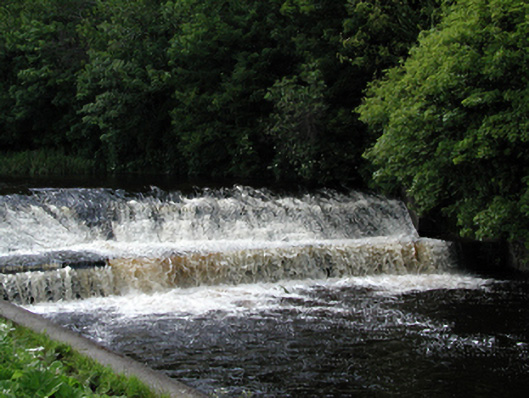
Description
Two stage weir in the River Dodder, c.1800, originally supplying water for a mill stream. First tier constructed of cobbled slabs, cobbles and cement, has a curving profile over c.10 metres with a drop of c. 3 metres. Second tier constructed of slabs, has a length of c.5 metres and vertical drop of c. 2 metres. Overall width of c.25 metres leads to millstream, sluice and overflow on north bank. Substantial revetment walls downstream.
Appraisal
Though now obsloete, this weir today provides a stimulating sight on the River Dodder, and is a recreational fishing location. It is an important remnant of the industrial age in this area.