Survey Data
Reg No
11209088
Rating
Regional
Categories of Special Interest
Technical
Original Use
Bridge
In Use As
Bridge
Date
1800 - 1820
Coordinates
305580, 230253
Date Recorded
12/06/2002
Date Updated
--/--/--
Description
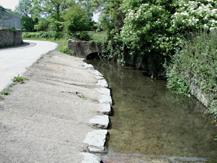
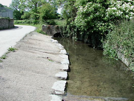
Section of watercourse, c.1810, with single arch rubble stone bridge having cut stone voussoirs to each end. Canalised limestone-lined stream between bridges, with shallow inclined bank to south side having squared limestone kerbing.
Appraisal
This feature is an ancillary structure associated with the former Corkagh House. Retaining much original fabric, it is an unusual feature combining practicality and elegance. A feature such as this is an important reminder of the history of the surrounding parkland and the heritage of the Clondalkin area.