Survey Data
Reg No
15310096
Rating
Regional
Categories of Special Interest
Archaeological, Social
Original Use
Well
In Use As
Well
Date
1815 - 1820
Coordinates
244003, 252758
Date Recorded
20/07/2004
Date Updated
--/--/--
Description
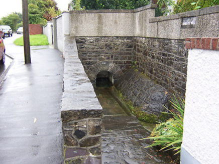
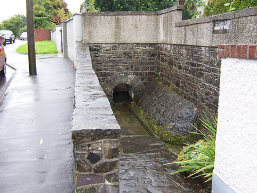
Freestanding water well, dated 1816, comprising a round-headed arch with roundly dressed voussoirs set into a section of strap-pointed squared rubble limestone wall. Paved gully to the west side. Located to the west end of Sunday’s Well and to the southeast of Mullingar.
Appraisal
A simple but interesting feature of social significance, adding historic interest to the streetscape to the southeast side of Mullingar. Although recently repointed, this modest structure is constructed using good quality local limestone. The name suggests that this may be a holy well and of archaeological significance. However, there is no obvious associated with an early religious site in the area.