


Survey Data
Reg No
22111001
Rating
Regional
Categories of Special Interest
Architectural, Technical
Previous Name
Suir Flour Mill
Original Use
Mill (water)
In Use As
Bakery
Date
1780 - 1820
Coordinates
205774, 125883
Date Recorded
27/06/2005
Date Updated
--/--/--
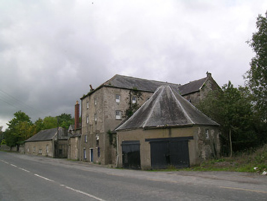
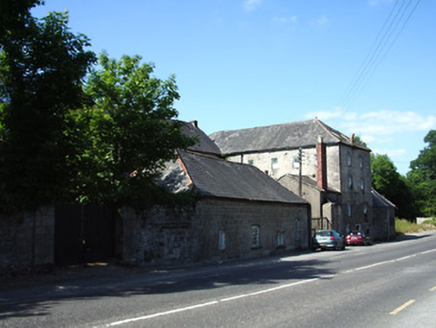
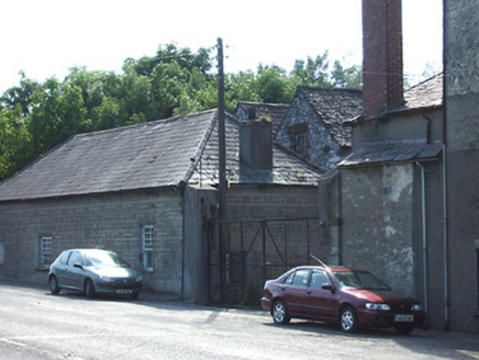
Description
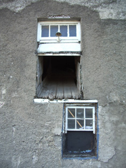
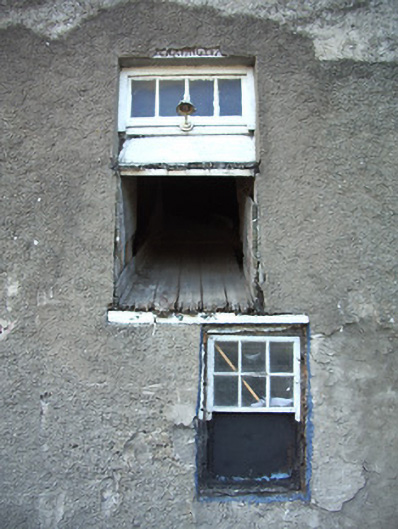
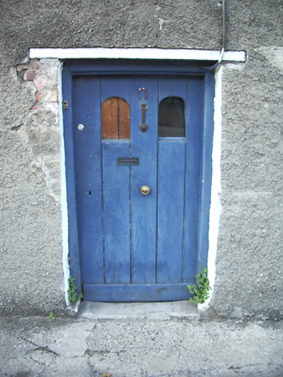
Detached mill complex, built c. 1800, comprising seven-bay four-storey L-plan block with attic, having seven-bay four-storey block attached to south-west, octagonal structure added c. 1860 to north-east, two-storey dwelling to south, two-pile two-storey building with attic to south-west and four-bay single-storey block to front of site at south. Hipped slate roofs to road gable of L-plan block and to single-storey and two-storey front blocks, pitched slate elsewhere, with red brick chimneystacks and cast-iron rainwater goods and with rooflights and eaves course to main block. Octagonal pyramidal roof to octagonal building, with lead flashing. Roughcast rendered random rubble stone walls to main blocks and to two-storey blocks at south-west, coursed snecked stone to single-storey front block. Square-headed timber sliding sash windows to four-storey blocks, with mainly six-pane upper lifts over boarded lower, with some eight-pane upper lifts. Fixed timber frame and timber casement elsewhere, with replacement uPVC windows to dwelling and brick surrounds to two-storey south-west blocks. Square-headed door openings, having timber battened door with round-headed glazed panels to road gable of main block, and timber battened double-leaf doors to octagonal structure. Timber plank chute to first floor of road gable. River Suir flows past rear of complex.
Appraisal
This significant and densely built former mill complex is sited on a key location along the eastern bank of the River Suir. Many interesting features remain intact, such as the windows, and the slated roof of the unusual octagonal building.