
Survey Data
Reg No
41401238
Rating
Regional
Categories of Special Interest
Architectural, Historical, Technical
Original Use
Bridge
In Use As
Bridge
Date
1710 - 1860
Coordinates
253811, 325592
Date Recorded
05/05/2012
Date Updated
--/--/--
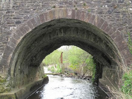
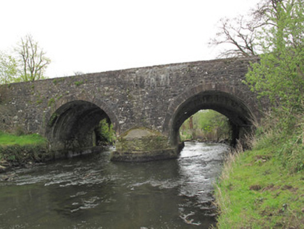
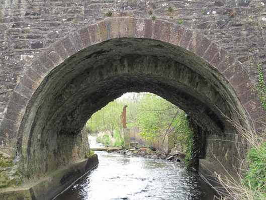
Description
Two-arched bridge, built c.1720, widened c.1800 and again c.1850. Round arches to north elevation, with tooled stone voussoirs, gauged masonry round arch to earlier section and gauged masonry pointed arch to south elevation, with gunnelled soffits. Coursed rubble stone walls to spandrels and parapets. West of parapet wall to south elevation rendered, having render capping. Coursed rubble stone buttress to pier to south elevation, central pier reinforced with concrete. Rubble stone V-shaped cutwater to north side of central pier.
Appraisal
This bridge was built in a number of phases, as is evidenced by the varying levels of soffits and shapes of the arch rings. These traces of adaptation and change add an important patina of age to the site. It may have been built in conjunction with the adjacent corn mill, which itself was rebuilt on a number of occasions throughout the eighteenth and nineteenth centuries. The bridge provides an important transport link and is indicative of the early improvements in the transport network from the eighteenth century.