
Survey Data
Reg No
41310082
Rating
Regional
Categories of Special Interest
Architectural, Historical
Previous Name
Shirley House
Original Use
Stables
In Use As
House
Date
1770 - 1800
Coordinates
283960, 303651
Date Recorded
30/07/2012
Date Updated
--/--/--
Description
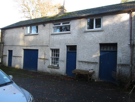
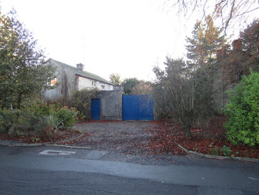
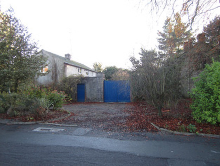
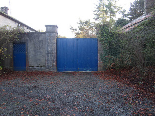
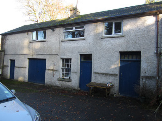
Detached stable yard, built c.1785, associated with now demolished Shirley House, comprising two multiple-bay two-storey blocks presenting slight round-headed recesses. North-east block now in use as dwelling. South-western block in use as outbuilding and has full-length part-stone and part-brick lean-to block to front. Pitched slate roofs with dressed limestone chimneystacks, one partly brick. Rendered walls with chanelled limestone quoins. Square-headed replacement uPVC windows to dwelling. Barred timber sliding sash window visible to road gable of second block. Yard has roughcast rendered walls with limestone plinths and copings, and square-plan ashlar piers with plinths and caps and supporting double-leaf timber battened vehicular gate. Square-headed pedestrian entrance to north-east of vehicular entrance having chamfered dressed limestone surround with replacement timber battened door. Elliptical-headed archway to south-east side of yard set in rendered wall.
Appraisal
This stable yard is a reminder of the now demolished town house of the Shirley family which stood on the opposite side of Shirley House Lane. The Shirleys ran one of the two estates that established and shaped the town of Carrickmacross: the south-western block is labelled as "Shirley Estate Rent Office" on the Ordnance Survey County Monaghan Carrickmacross Sheet 3 (1862). The stable yard is distinguished by the fine gate piers,