Survey Data
Reg No
41303055
Rating
Regional
Categories of Special Interest
Architectural, Technical
Original Use
Bridge
Date
1835 - 1845
Coordinates
268074, 333886
Date Recorded
14/10/2011
Date Updated
--/--/--
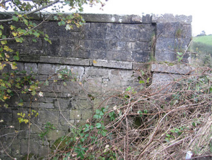
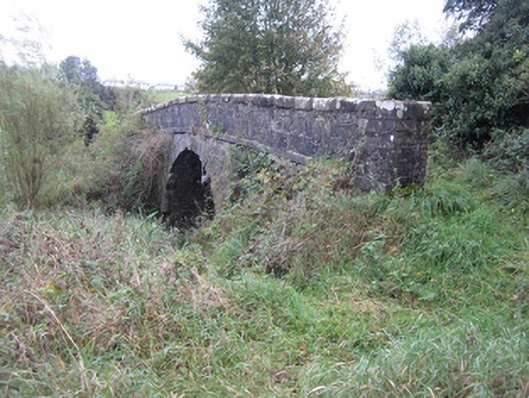
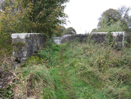
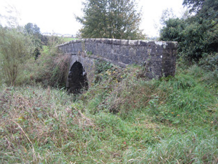
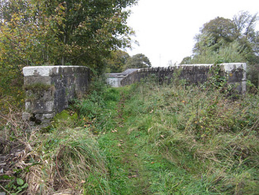
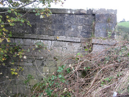
Description
Single-arch limestone canal bridge and adjacent stone culvert, built c.1840, carrying access lane from Asylum Farm over Ulster Canal and towpath and sluiceway short distance south of seventeenth lock to small roadway and associated farmland to south-east. Parapet walls of roughly squared rubble with heavy, flat capping stones having rounded arrises and punch-finished surface. Square piers having heavy flat stone caps terminate each corner of parapets. Projecting square string course separates parapet from spandrels which have same construction as parapet walls. Segmental arch has punch-finished ashlar voussoirs and stone arch soffit over canal and towpath which is on ashlar sandstone raised eastern bank of canal. Both elevations obscured by ivy and trees growing on embankments either side of disused canal. Tree growth and ivy restricts views of some parts of bridge and top surface overgrown with grass with no evidence of hard surfacing or drainage. Barrel-vaulted ashlar stone culvert over sluiceway just east of canal bridge. Abutment walls are reinforced with concrete and culvert provides channel under earthen bank.
Appraisal
This is a fine example of early to mid-nineteenth-century canal architecture built to plans by Directors General of Inland Navigation engineer, John Killaly. The Ulster Canal was under construction at the time of Lewis' 1837 topographical survey of Monaghan and both structures stand as functioning and graceful elements of a now disused canal scheme. The high standard of design and well executed masonry of these structures which have served their purpose for at least one hundred and fifty years with no visible major repairs is a testament to the quality of the original design and masonry.